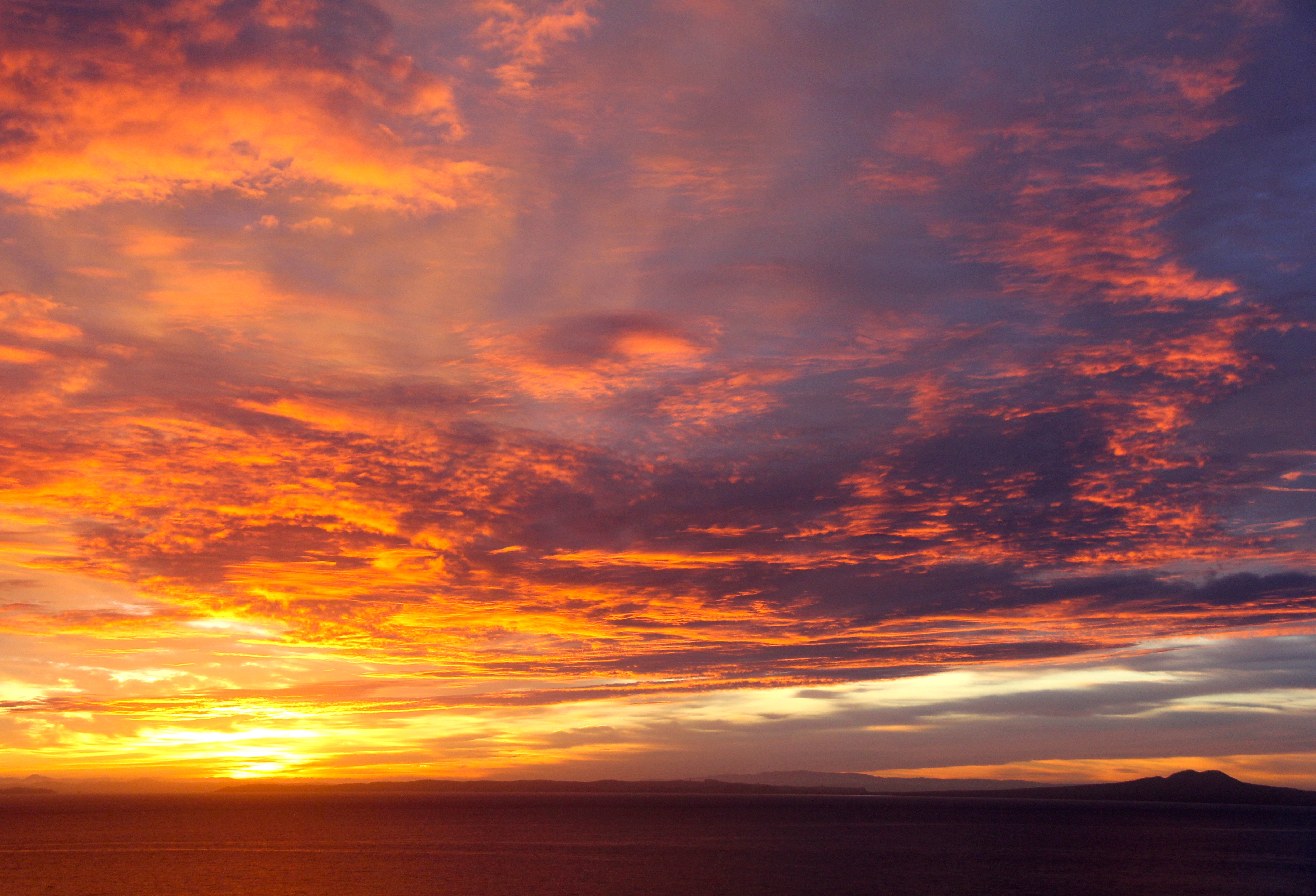
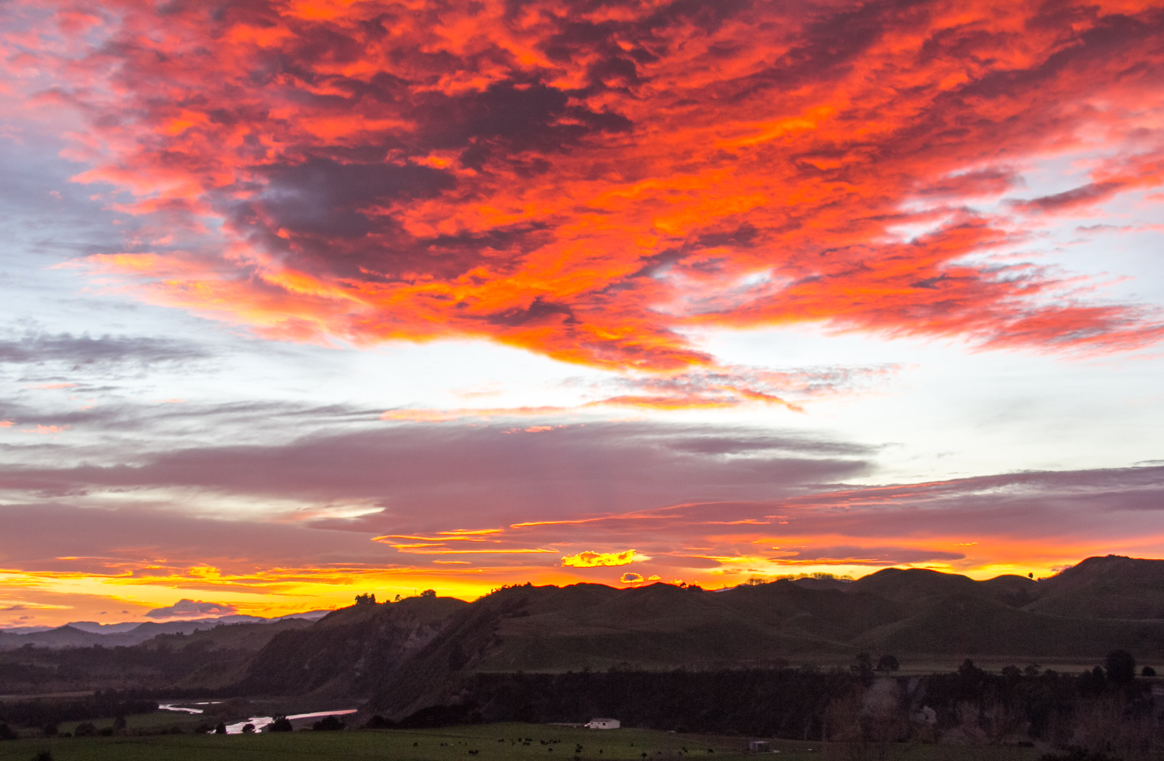
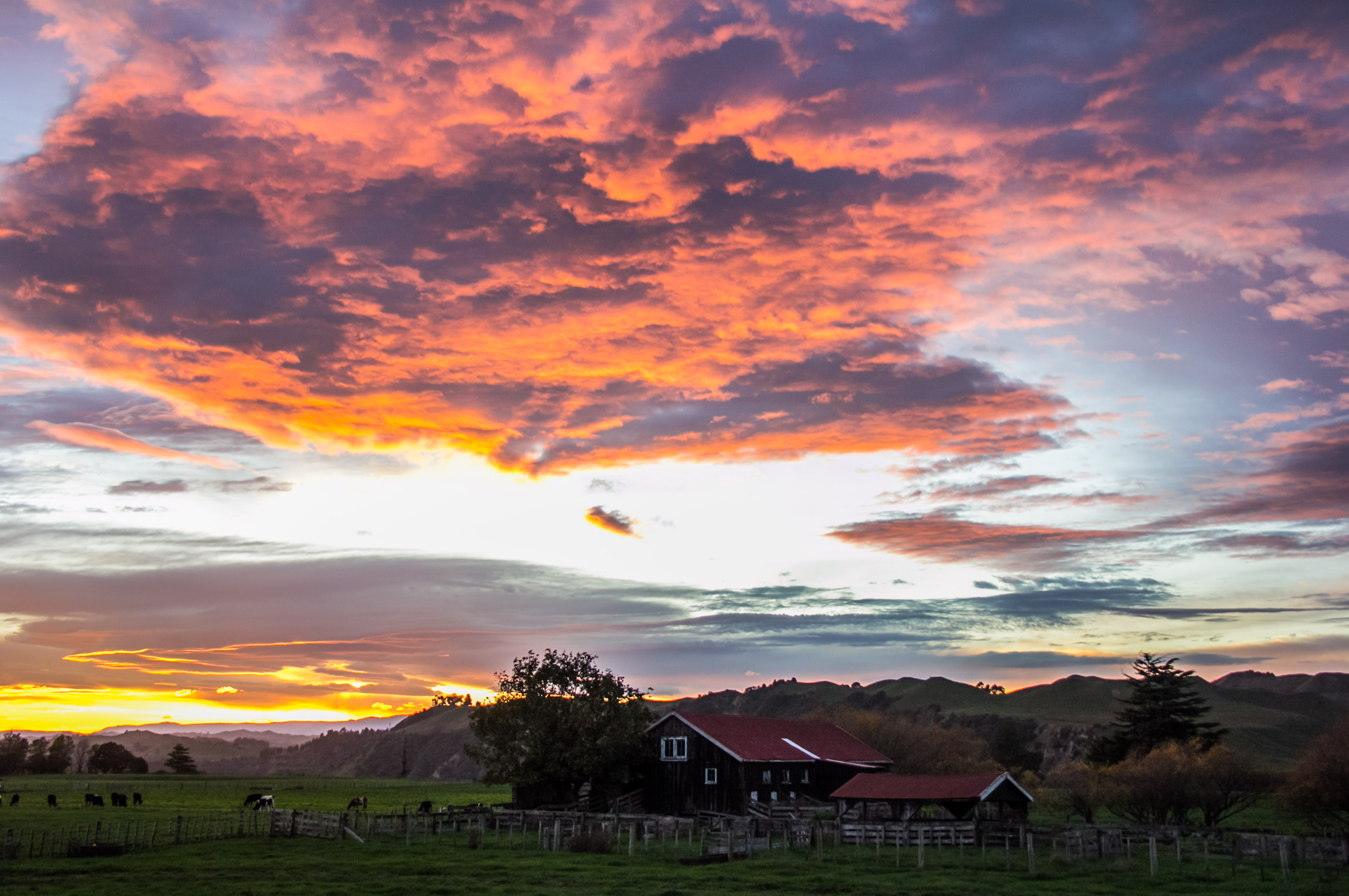
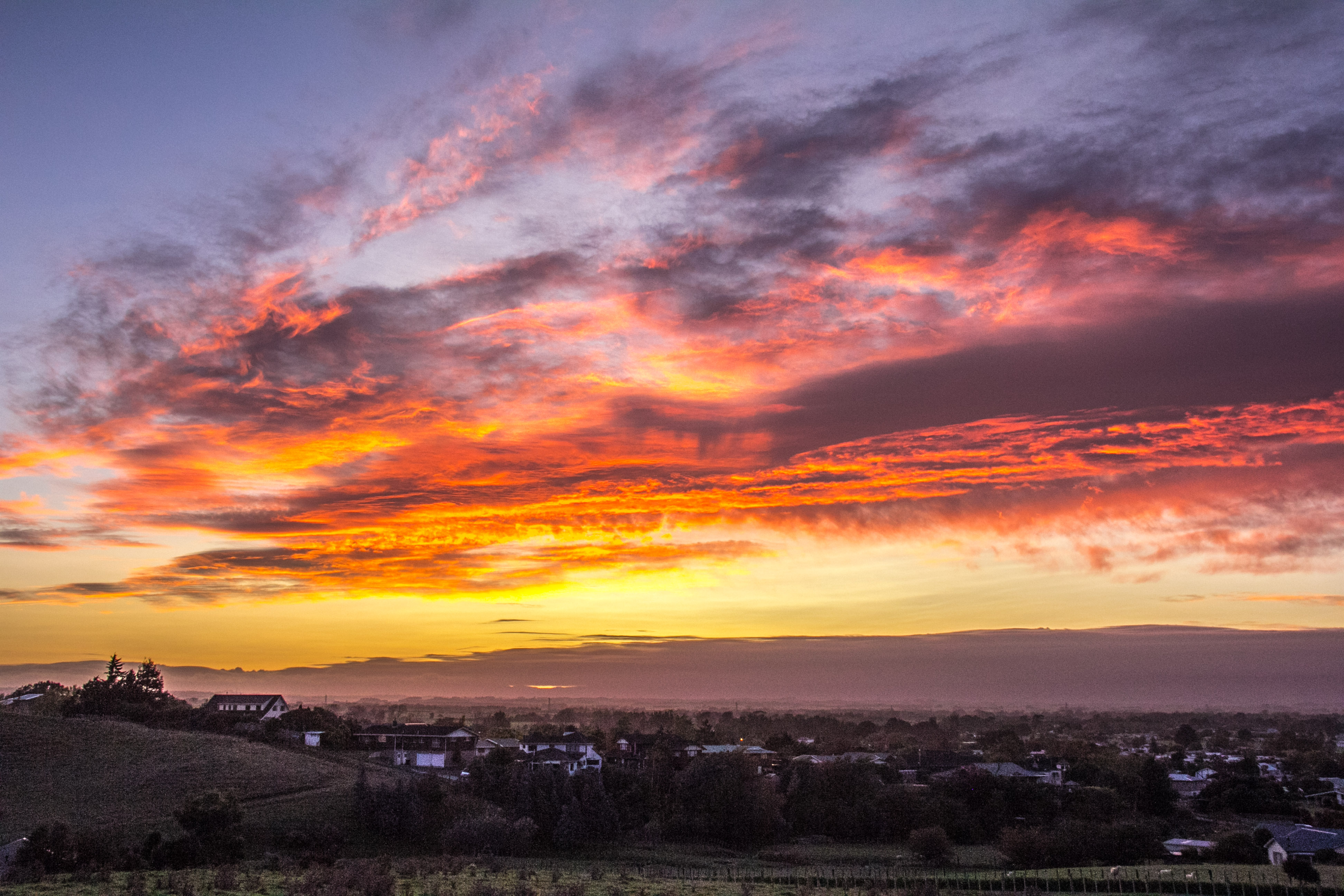
Because who doesn’t like to look at some epic cloud formations? Don’t ask me to go all scientific on you. I’m not a cloud geek, I don’t know what the clouds are called. I just like looking at and photographing some cloud action that’s worthy of capturing. I’ve already put a few photos throughout the blog which feature cool clouds, but they were incidental to the view. These ones are the reason I took the photo. It’s the subtle differences. If you know the names of the clouds, please comment and enlighten us all.
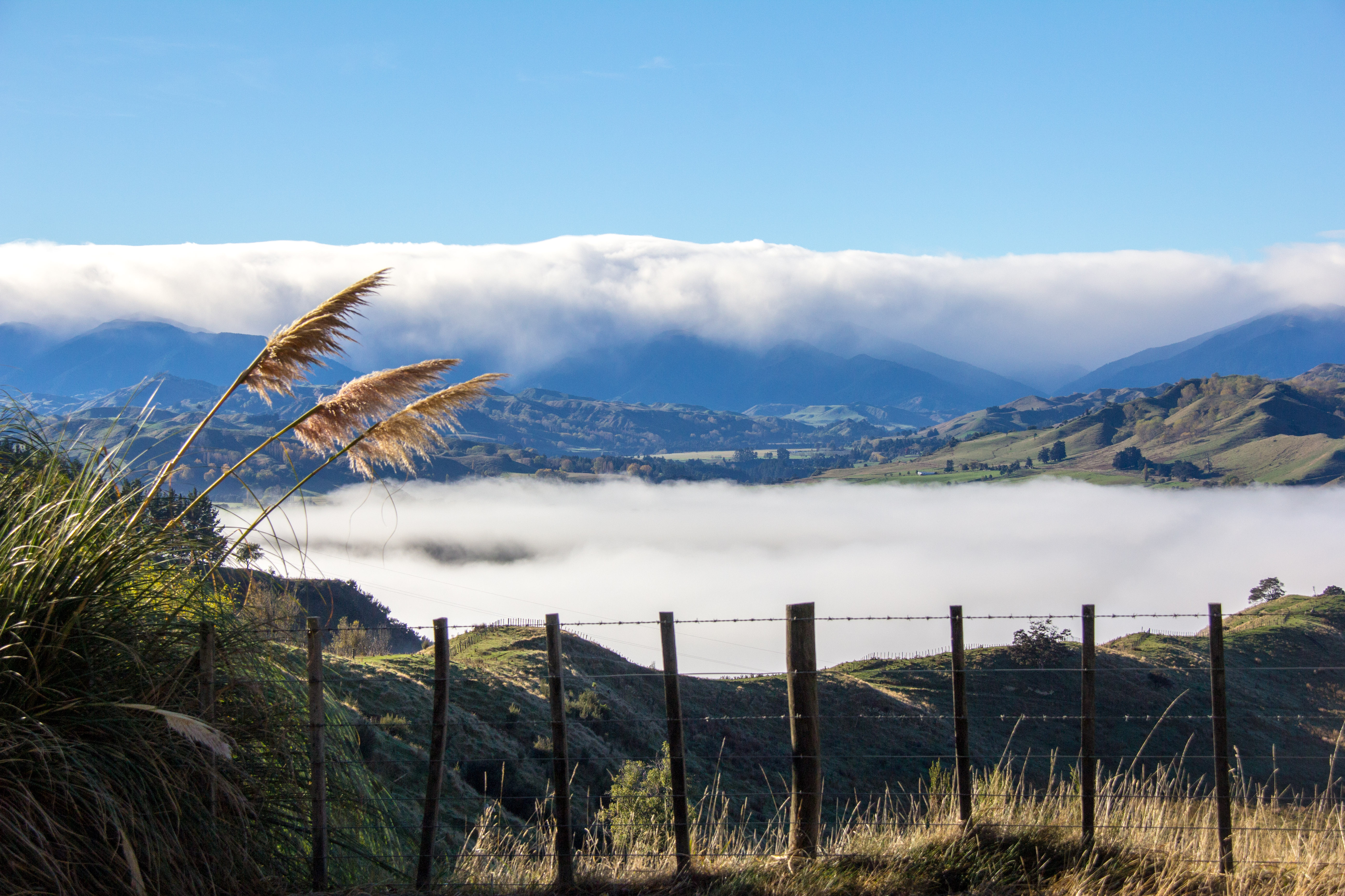
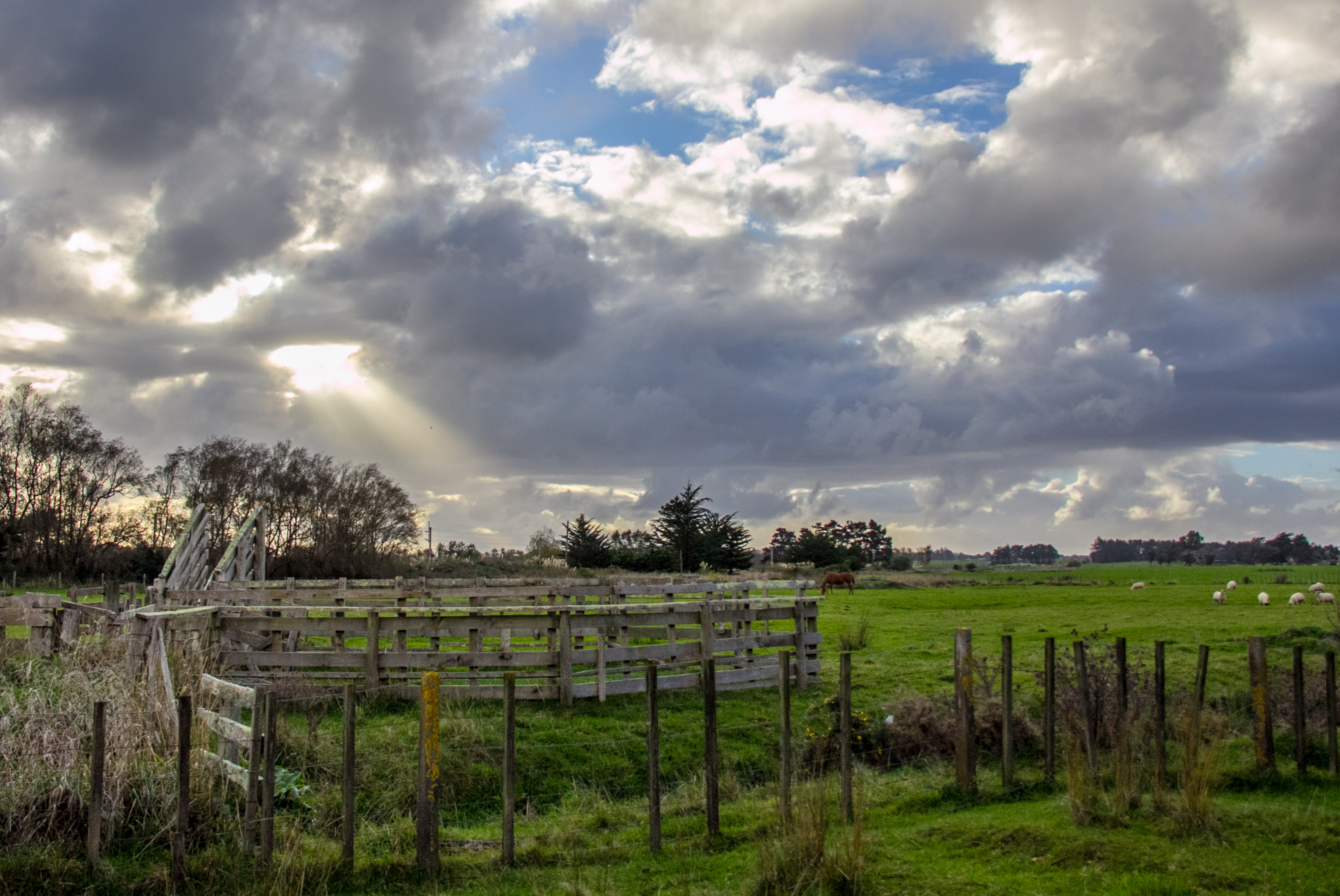
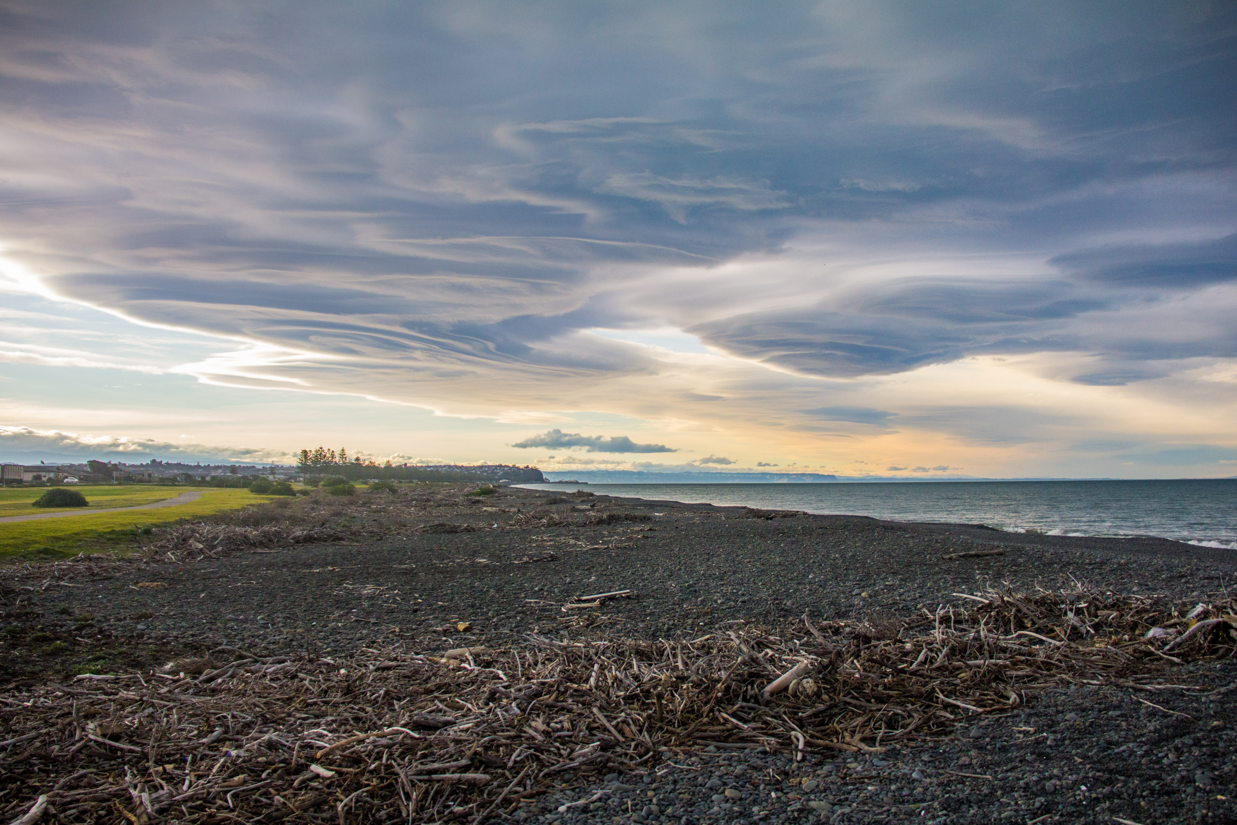
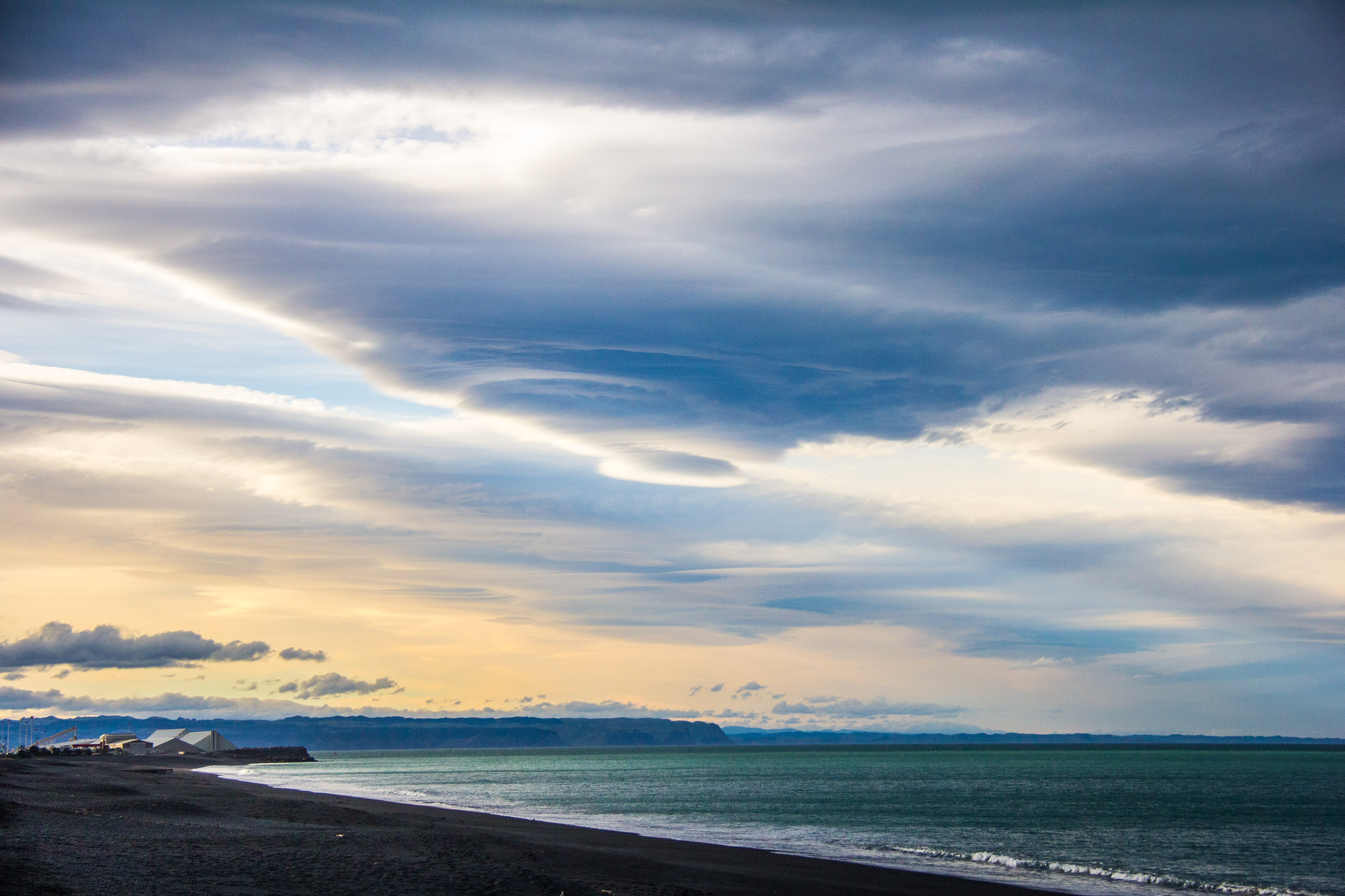
Southern Central Hawkes Bay, the day before the ‘great flood’ turned up in other parts of the country. Waipukurau, the nearest town to here was unaffected. The clouds were weird throughout Hawkes Bay that dayLooking North-East across Waipukurau in Southern Central Hawkes Bay. Storm brewing, but not here.I call these ‘God rays’, they are actually called ‘Crepuscular Rays’. Which sounds meteorological rather than awesome. These are over the small Rangitikei town of Hunterville, which few would describe as awesome.Rangitikei river valley, full of fog, love this stuff. There’s a river down there, I expect it has something to do with the valley hugging foggy clouds.I put a lot of care and thought into naming my images. I call this ‘Yard Rays’. I know.South of Napier, Hawkes Bay. Storm front brewing but the storm wasn’t here. Still, as you can see, the beach is not one for sunbathing so that’s good to know if you’d ever considered such a thing and felt a special trip to Napier might be in order. Make the trip by all means. Don’t swim or sunbathe, drink wine.Looks like a Tornado brewing over Napier in Hawkes Bay. It isn’t.Rays punching through the clouds above Lake Taupo.This is an unremarkable place in the Manawatu. Made interesting only by the sun striking through the clouds. I’m sure there is also lots of local history the local people are very proud of though.Cumulonimbus. I know I said I wasn’t going to name any clouds. But this is amazing. The entire top of the Whangaparoa Peninsula obliterated by a nuclear explosion, is what a Cumulonimbus looks like in this instanceOver there at the bottom right is Rangitoto Island to give some perspective to this epic cloud formation. Early morning in Arkles Bay.Same place, different day, slightly different angle. Big skies up there.Rangitito at Dusk, with a boat heading out to sea. This is the sort of thing you want to be looking at of an evening rather than the telly. Just saying.
So that’s it. When people say ‘it’s all cloudy’, that’s a good thing. See?
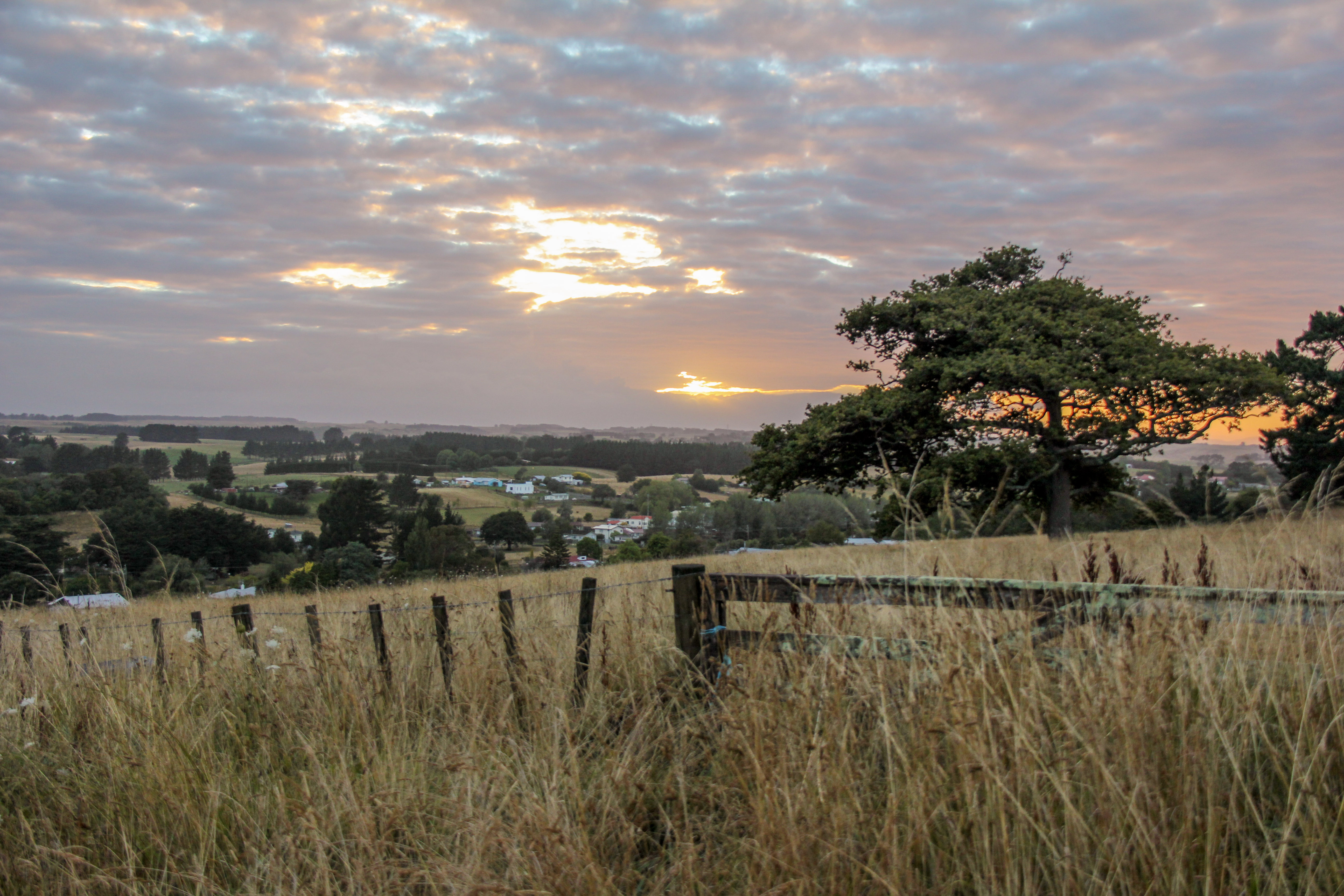
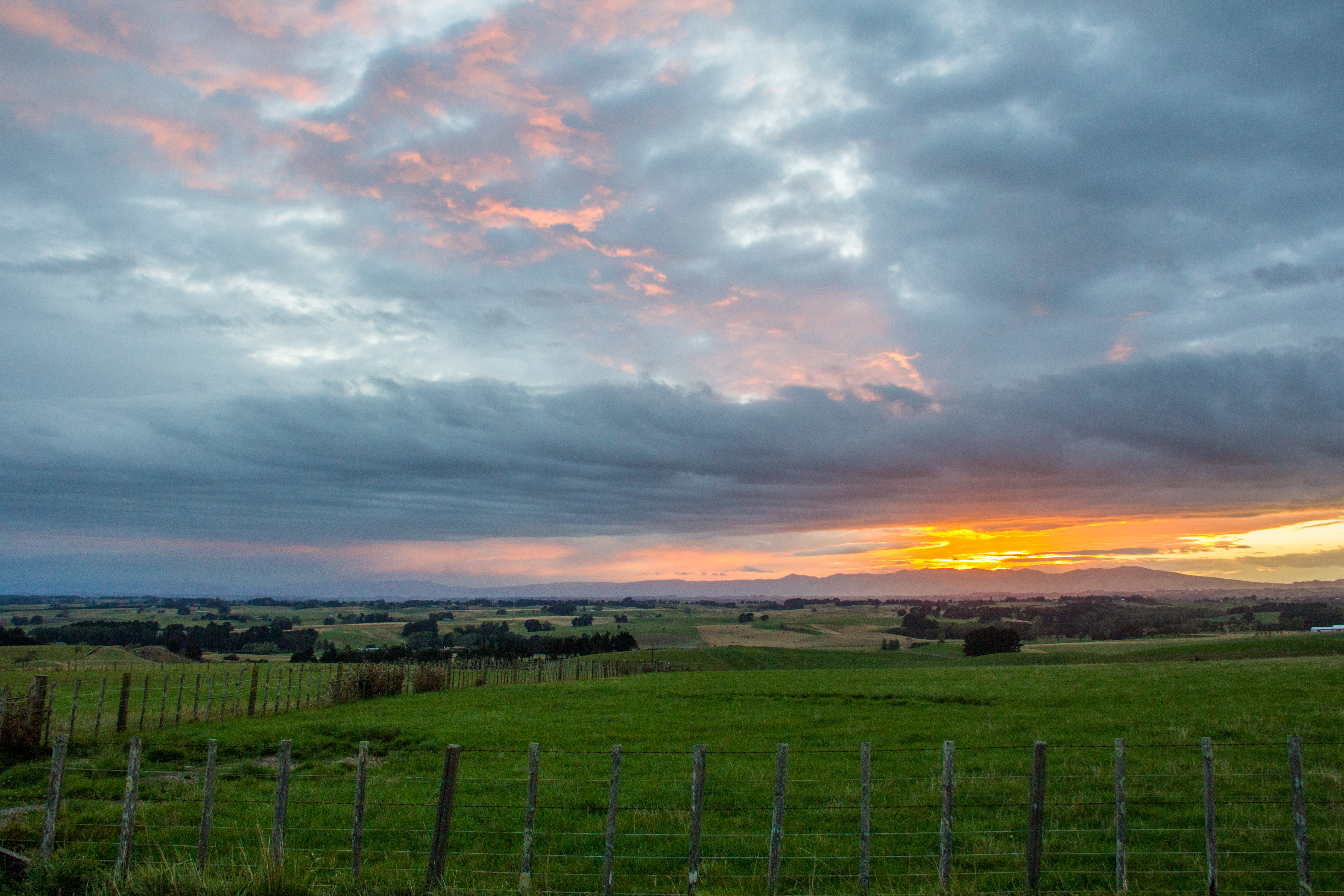
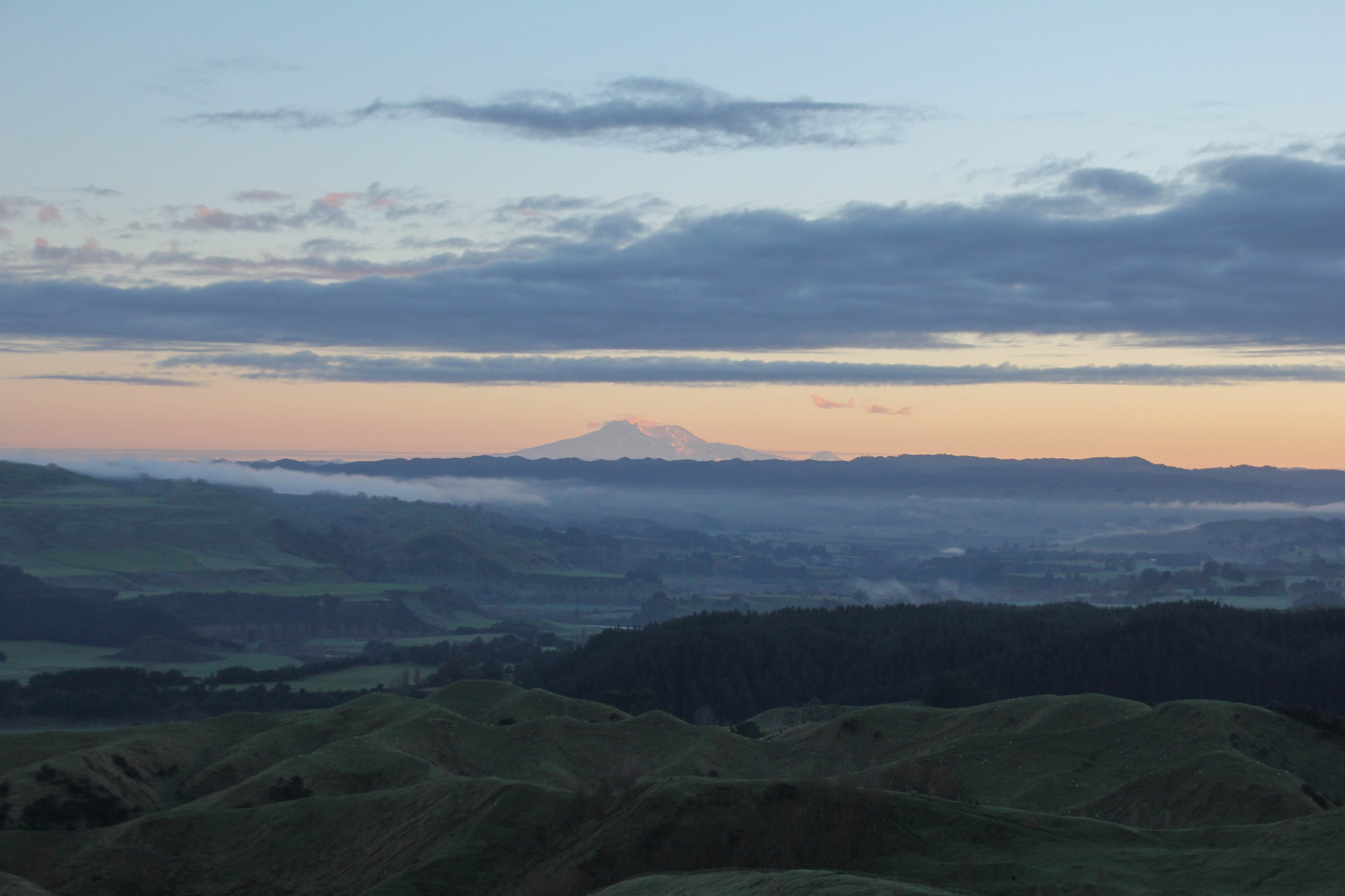
The centre being the central North Island, rather than the coast. So many people take wonderful photographs of the sun coming up over the sea. That’s easy to do, all you need is an alarm clock and to point your camera East in the morning. Inland it’s a bit more of a challenge. There are hills and stuff in the way. Here are a handful of local sunrises I’ve been lucky enough to witness.
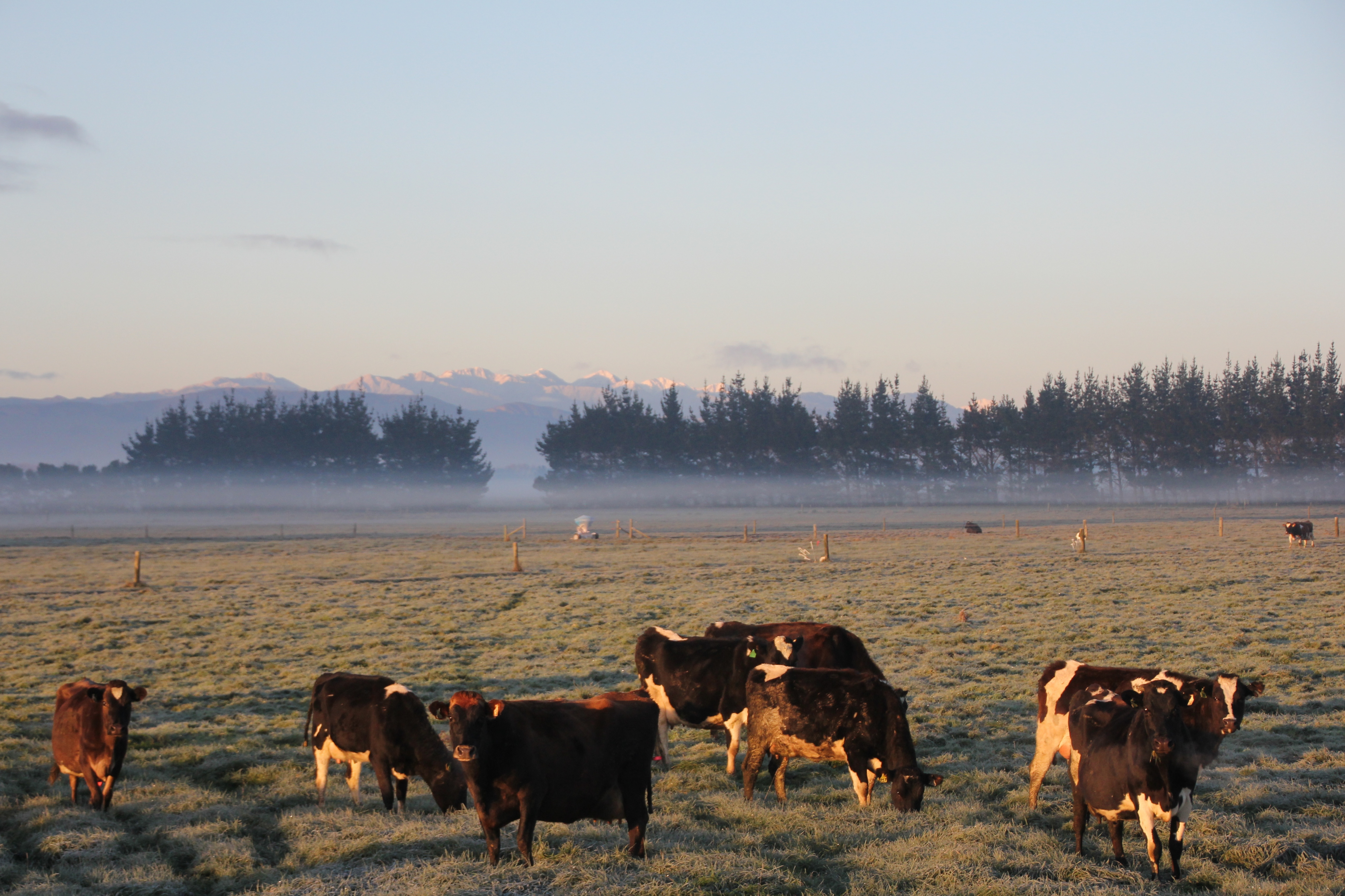
Cold cows, earlyHalcombe, 7 am or soRangitkei River. Steam off the water looks coolDerelict house, early, the ghosts aren’t even up yet.Manawatu Morning7am or so, from the Feilding-Halcombe road7ish, looking across the RangitikeiStill 7ish, bit of a theme of the hour in the morning setting in here.Mt’s Ruapehu and Ngauruhoe, about 120 kilometres away7am over Feilding. ManawatuRuapehu again, over there, miles away in the morningYou’ve heard of the Verve song, ‘The drugs don’t work’? This is the rural version ‘The cows don’t care’. Sunrise in the Manawatu.
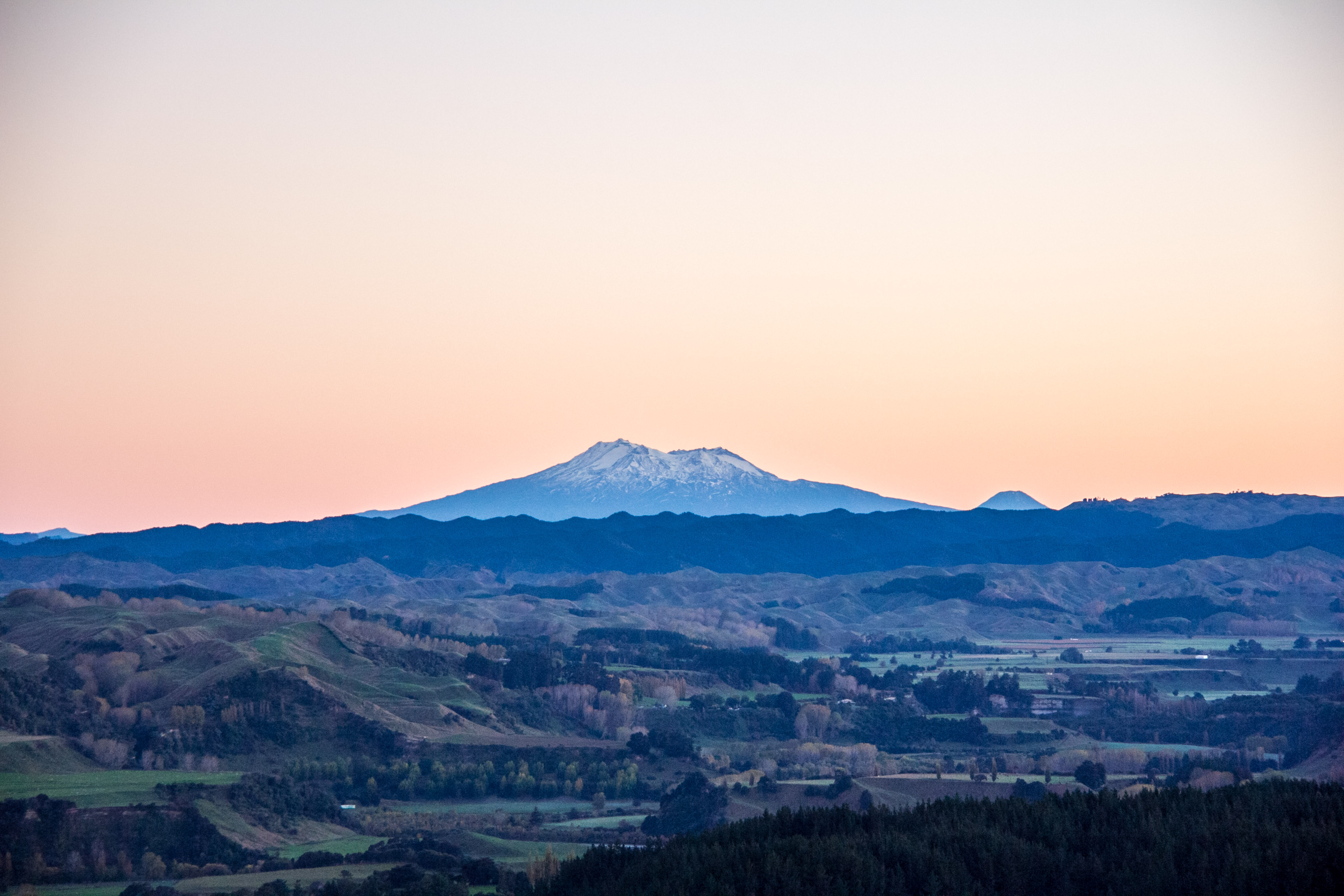
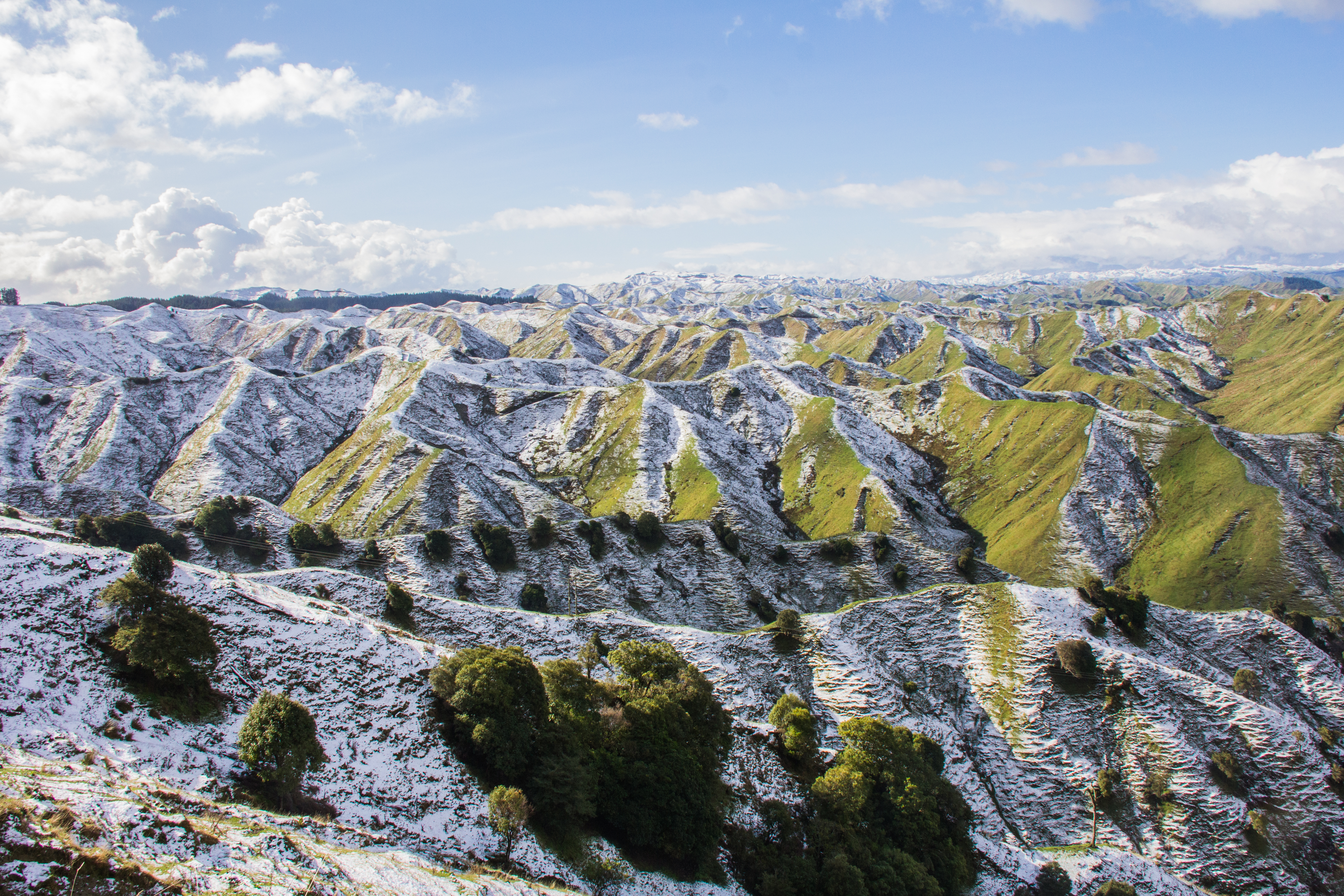
It’s the first official day of Winter in New Zealand on the 1st of June. I took these in the last couple of weeks, round my way. You don’t have to go to the South Island to see snowy peaks and mountain ranges. These were all taken within an hour of my place in the Rangitikei. Southern Central North Island.
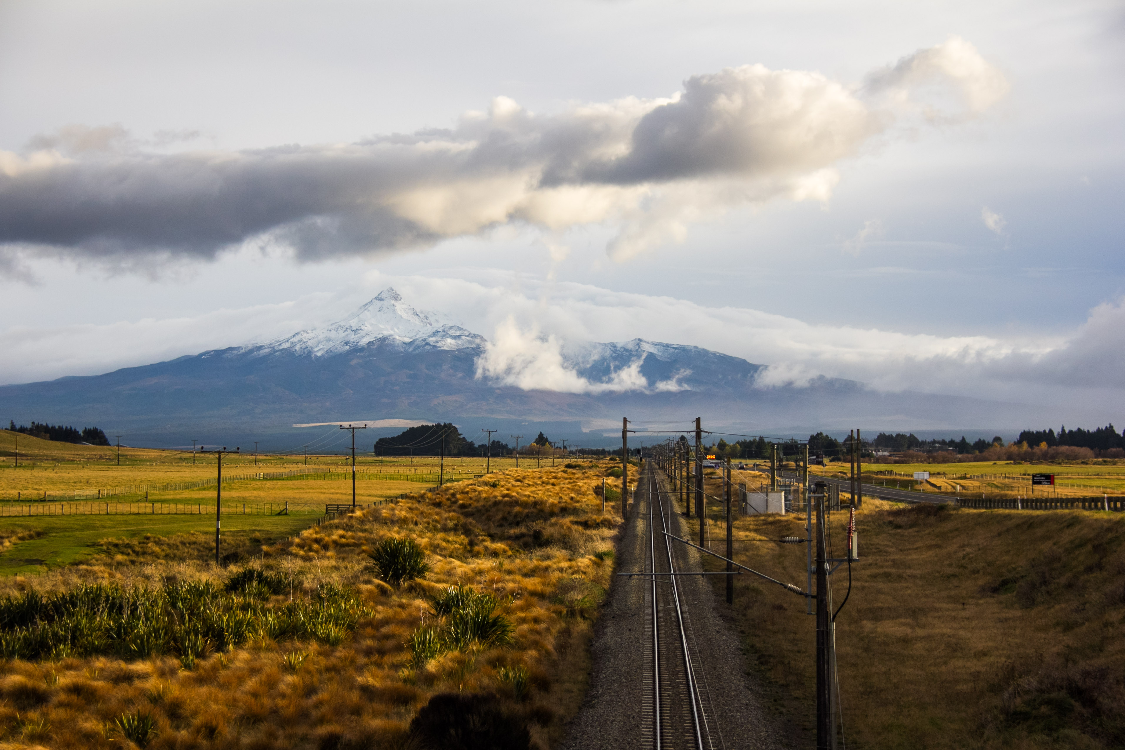
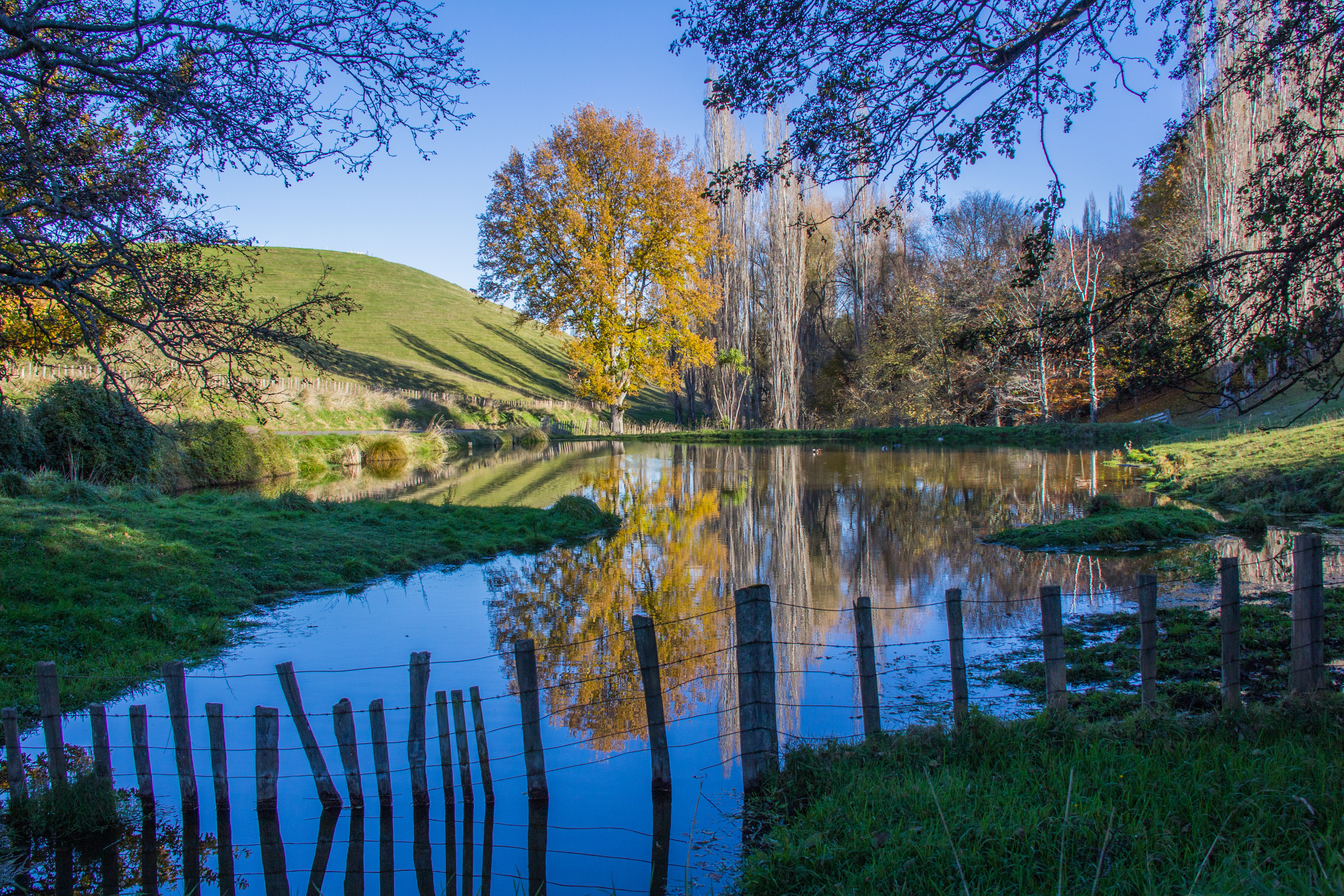
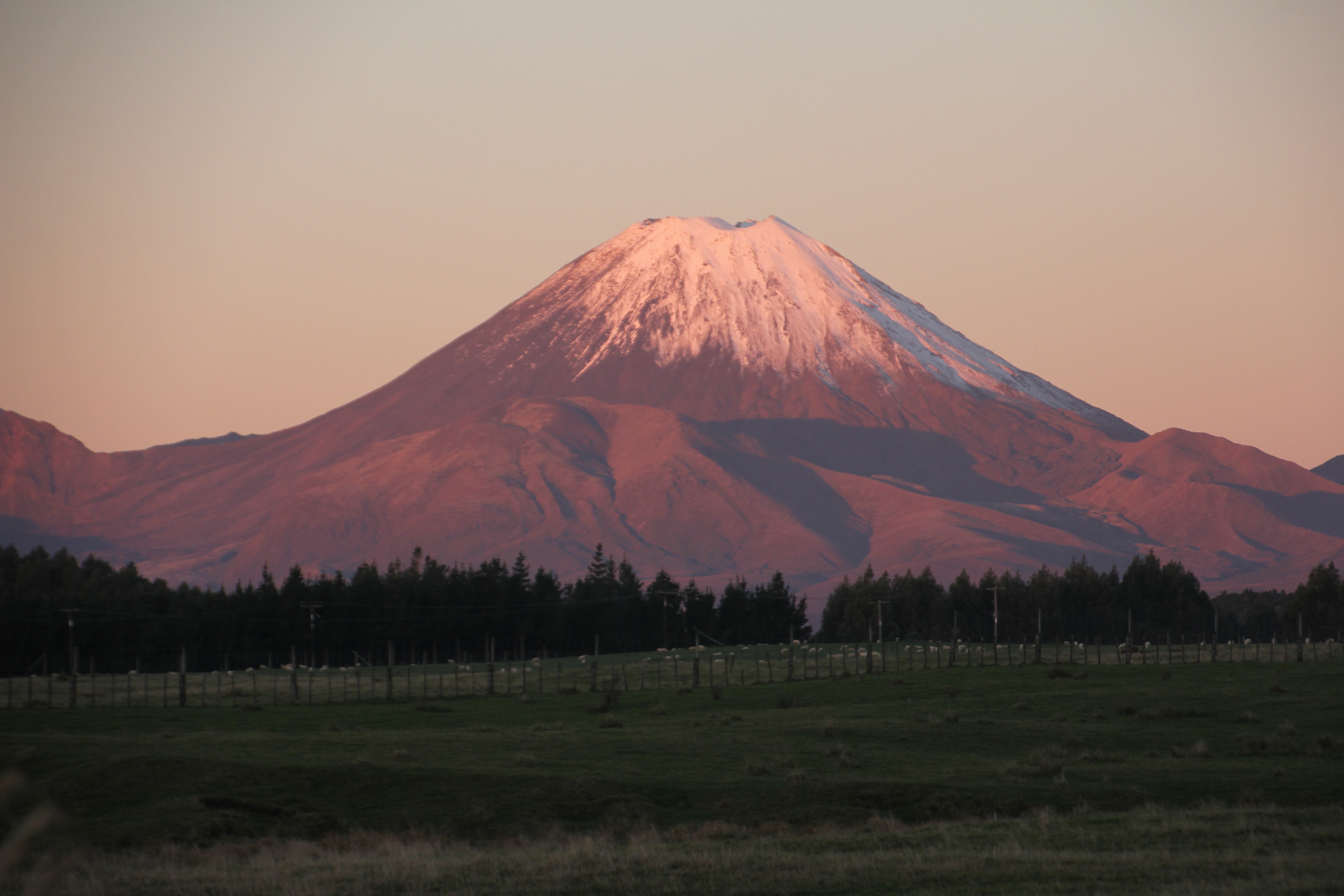
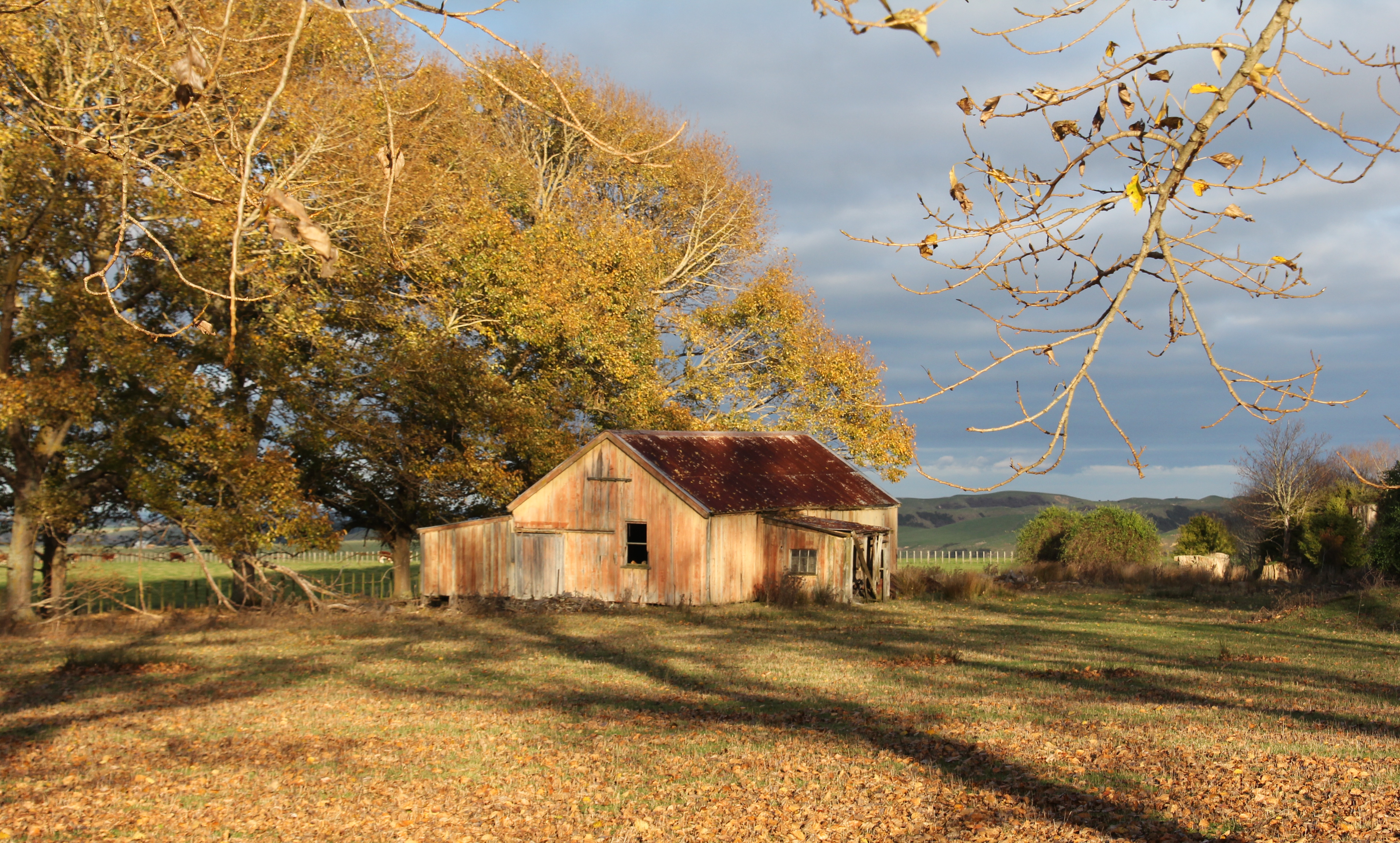
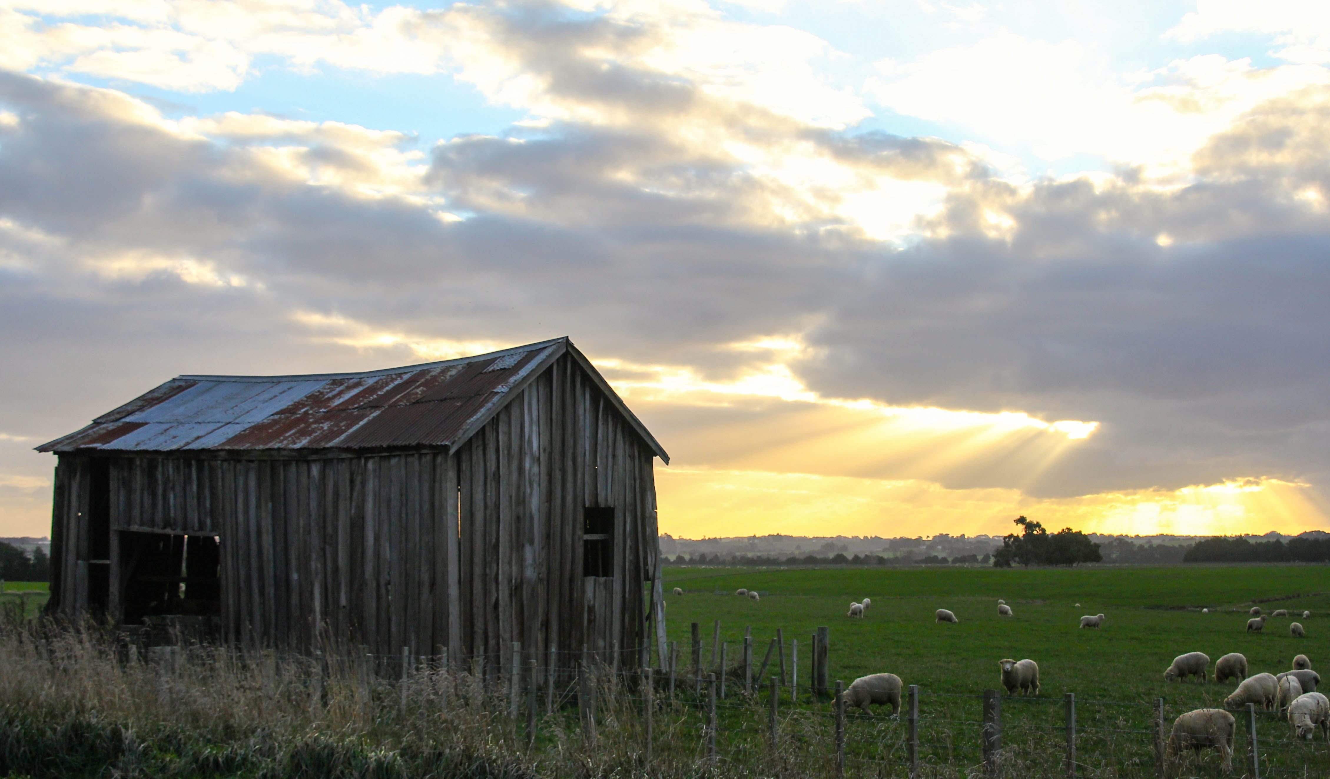
I call this one, ‘Top of the Mountain road’. I’ll let you puzzle over the hidden message in that title.I call this Ruapehu Space ship clouds. Took me ages to think that upThe New Zealand Main Trunk rail line, heading north towards Mt RuapehuI call this ‘Mountain Road’. Because I took it on the Mountain Road. No need to make up names when the actual name is cool enough.The open road, literally. The sign says so.The Ruahine Ranges again, looking across the Rangitikei River Valley. Snowy and sunny. A perfectly photogenic combinationWho doesn’t love a derelict barn with a tree growing out of the window on a remote country road. Just a hint of the Ruahine Ranges in the background.Mt Ruapehu, looking awesome on a partly cloudy crisp autumn day. For those unfamiliar with Mt Ruapehu, it’s a 10,000 foot high active Volcano in the middle of the North Island. 10,000 feet sounds more impressive that just shy of 10,000 feet which what it actually is. 9,177 feet in actual fact.Mt Ruapehu again, from Wanganui, or Whanganui if you preferNo snow here, but it’s not far away. This is beside the Moawhango Valley Road, not a road you are likely to find by accident. It’s up behind Taihape, in the middle of nowhere.Take extra care, like the sign says. Also the Desert Road isn’t really across a desert. It’s an Alpine Environment and quite un-desert like.This is also high in the Rangitikei Hill Country, an old woolshed looking cool in the snowy morning sunThat’s the mighty Rangitikei River Valley with a bit of snow on the Ruahine Ranges in the distance. Epic views across the lower North Island.We had a light dusting of snow in the Rangitikei hill country, I loved how the shadowed side of these hills took longer to thaw giving this cool effect on the landscape
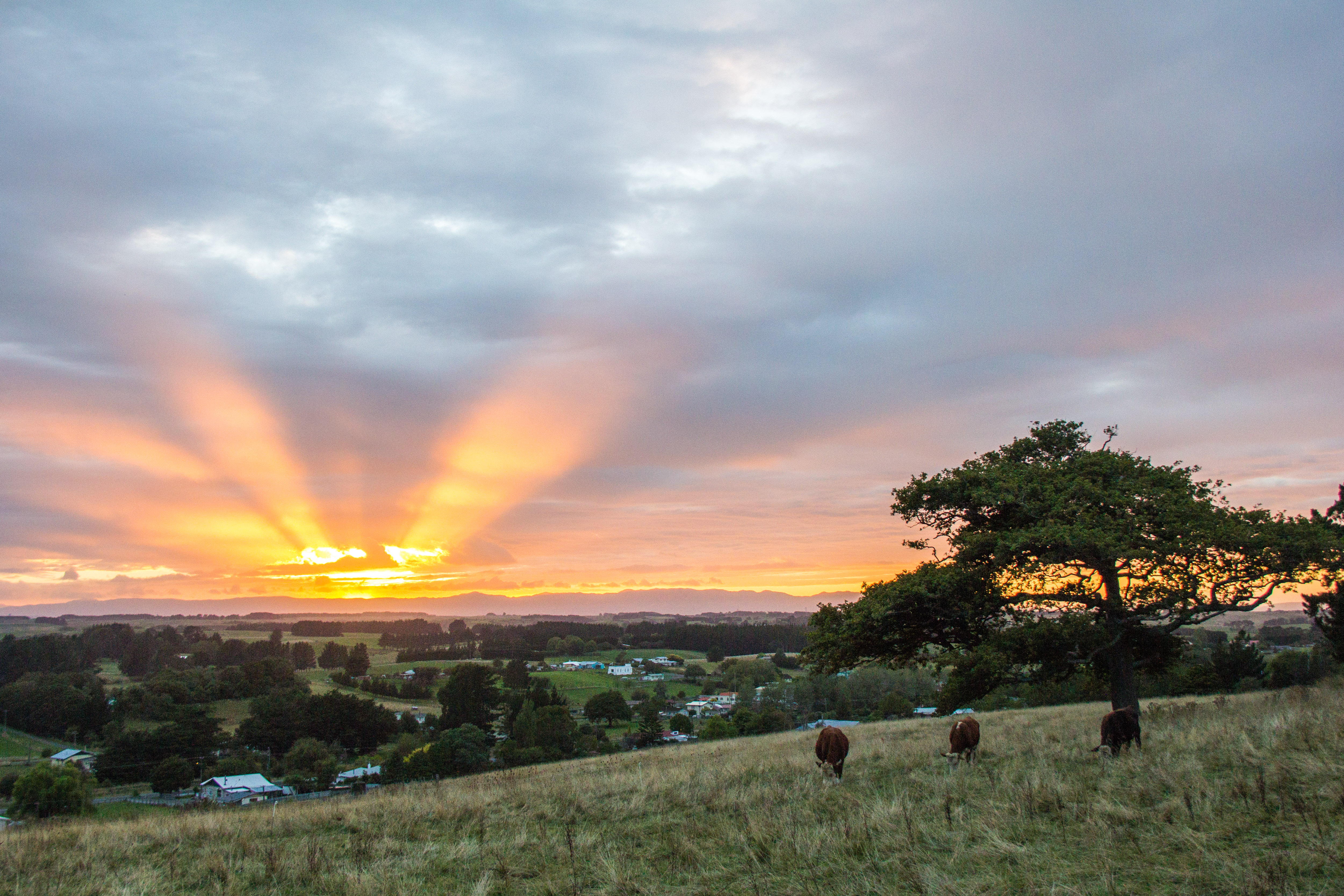
Apparently Pam arrives tomorrow, if she does. That’s Cyclone Pam of course. There were pretty amazing clouds developing in the North and East of where I live so I thought I’d pop out and take a few photos. These were taken in the space of an hour. Near my place.
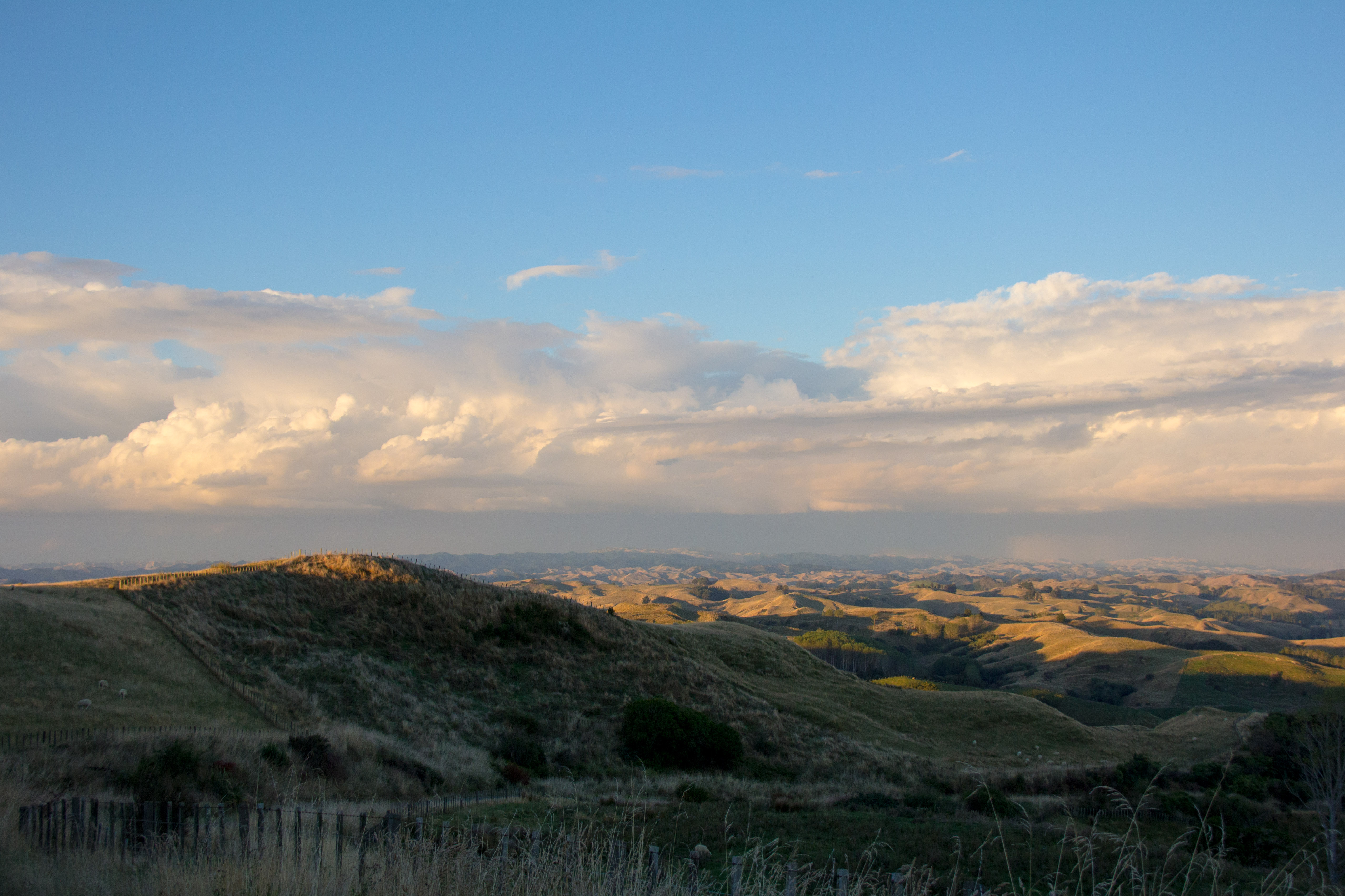
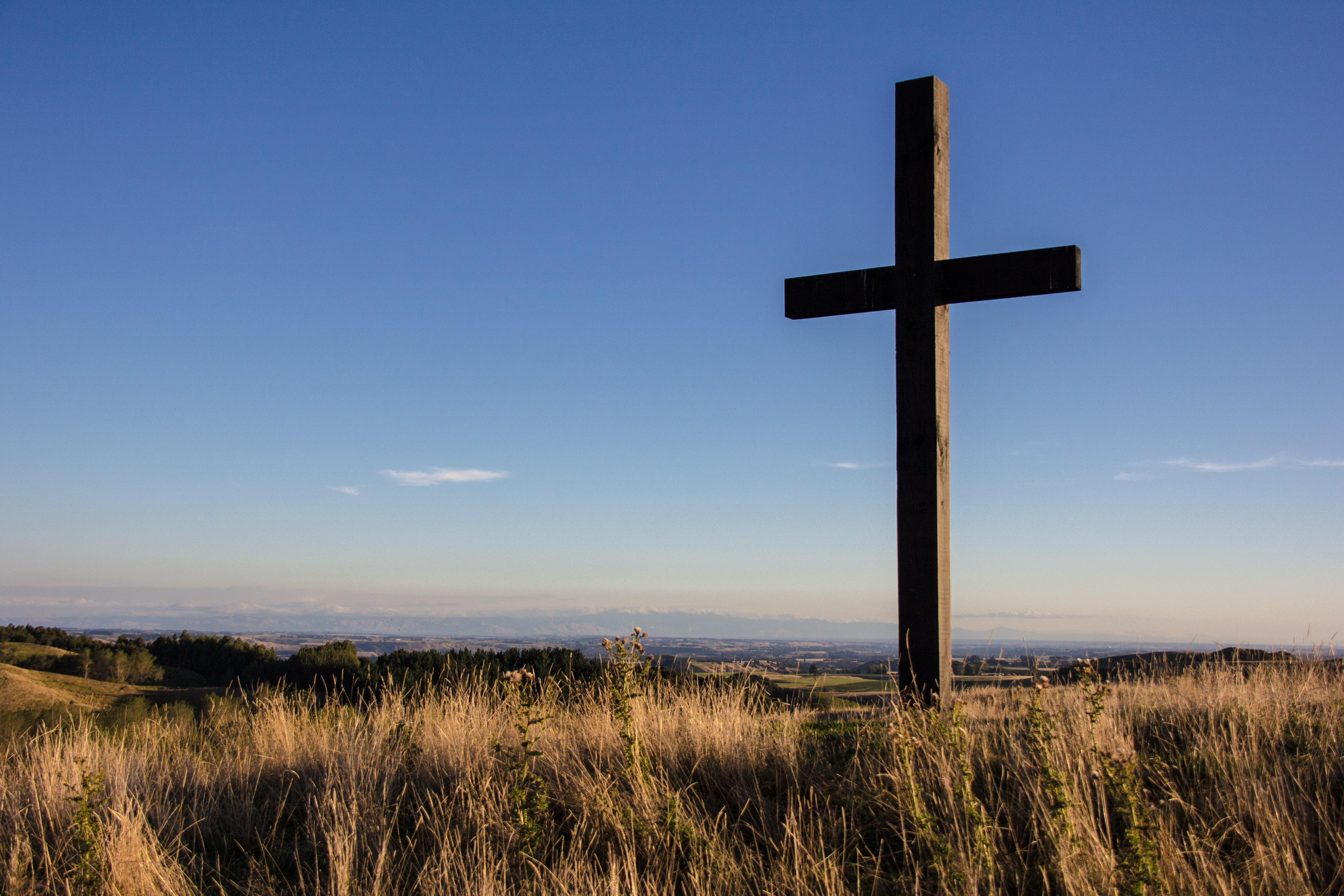
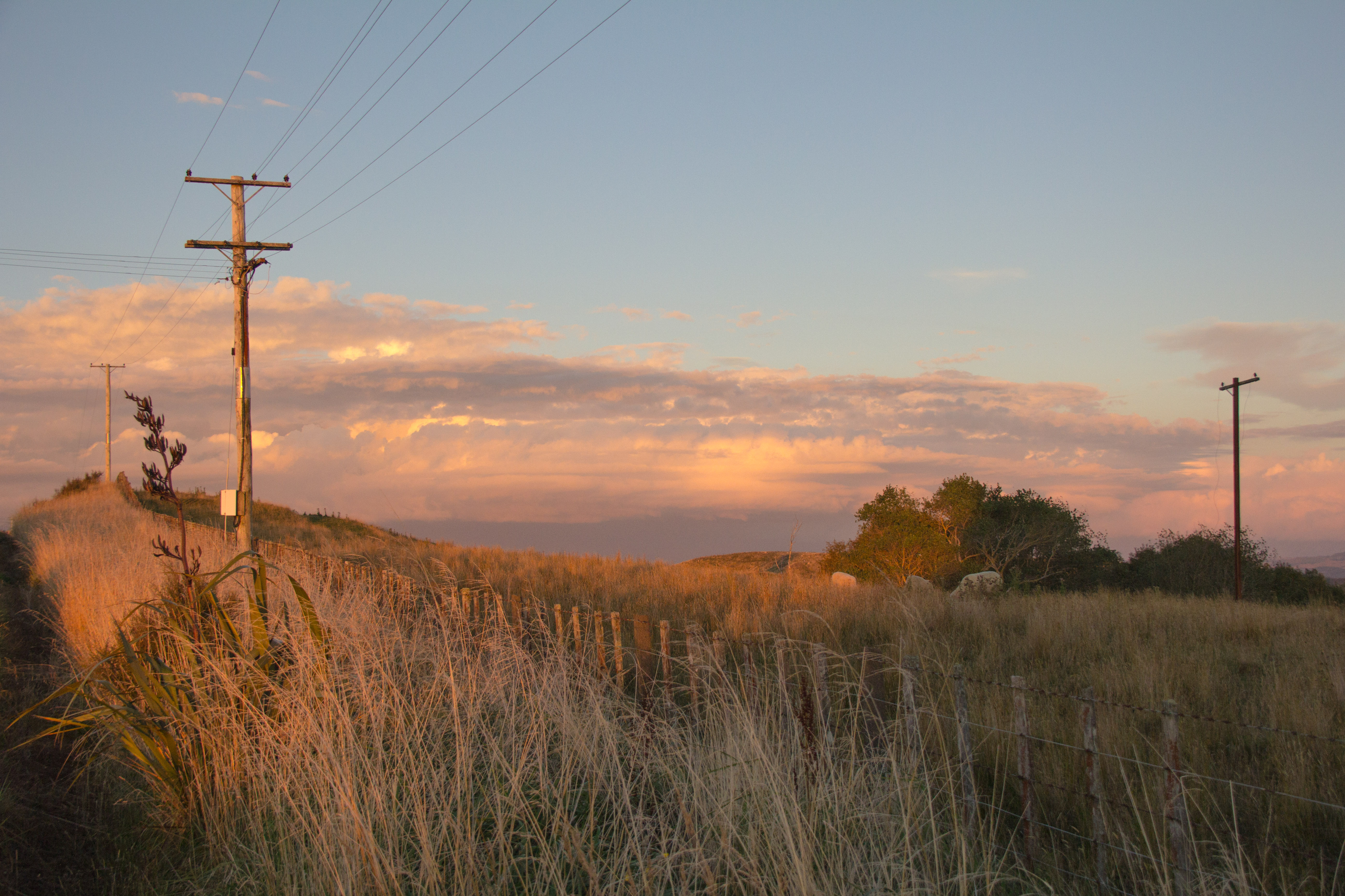
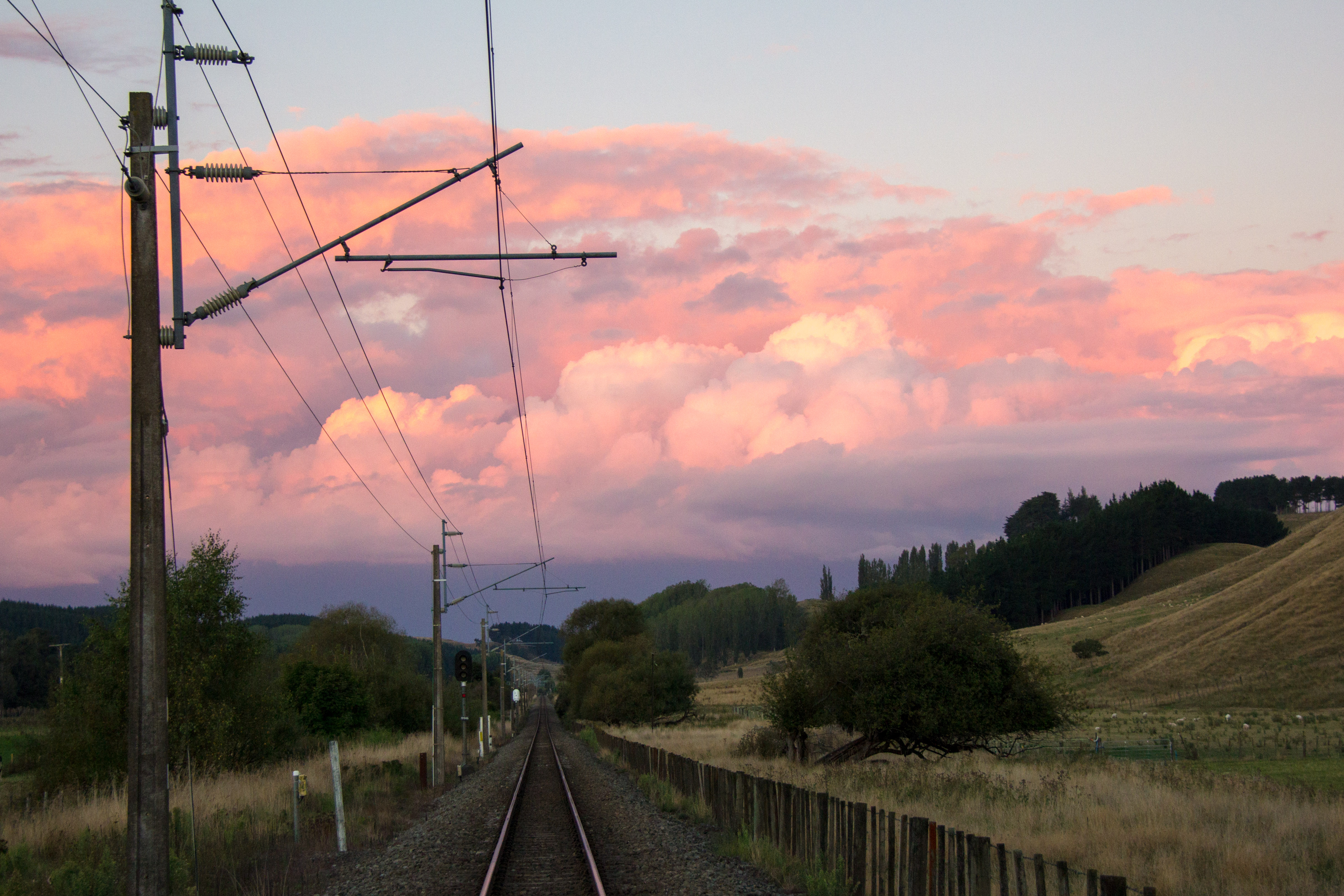
Look North, early evening, lumpy land, cool clouds.Cross. This is the monument to a local man who loved the area.What’s your beef? You can also see the Te Apiti Windmill Farm away in the distance at the bottom right of the image.LinesYards.Ducks crossing. There was a cool weather effect in the distance. Then some ducks flew through the shot which is cool.Without the ducks, just layers of land and evening cloud, with rainbow type thing.Rule of thirds, New Zealand style. Looking East towards the Manawatu.The local high ground. Trig on Mt Curl.Looking north, towards Hunterville.Looking up the line. The Main Trunk Line. New Zealands main rail line. From a crossing on a farmers land in the Rangitikei.
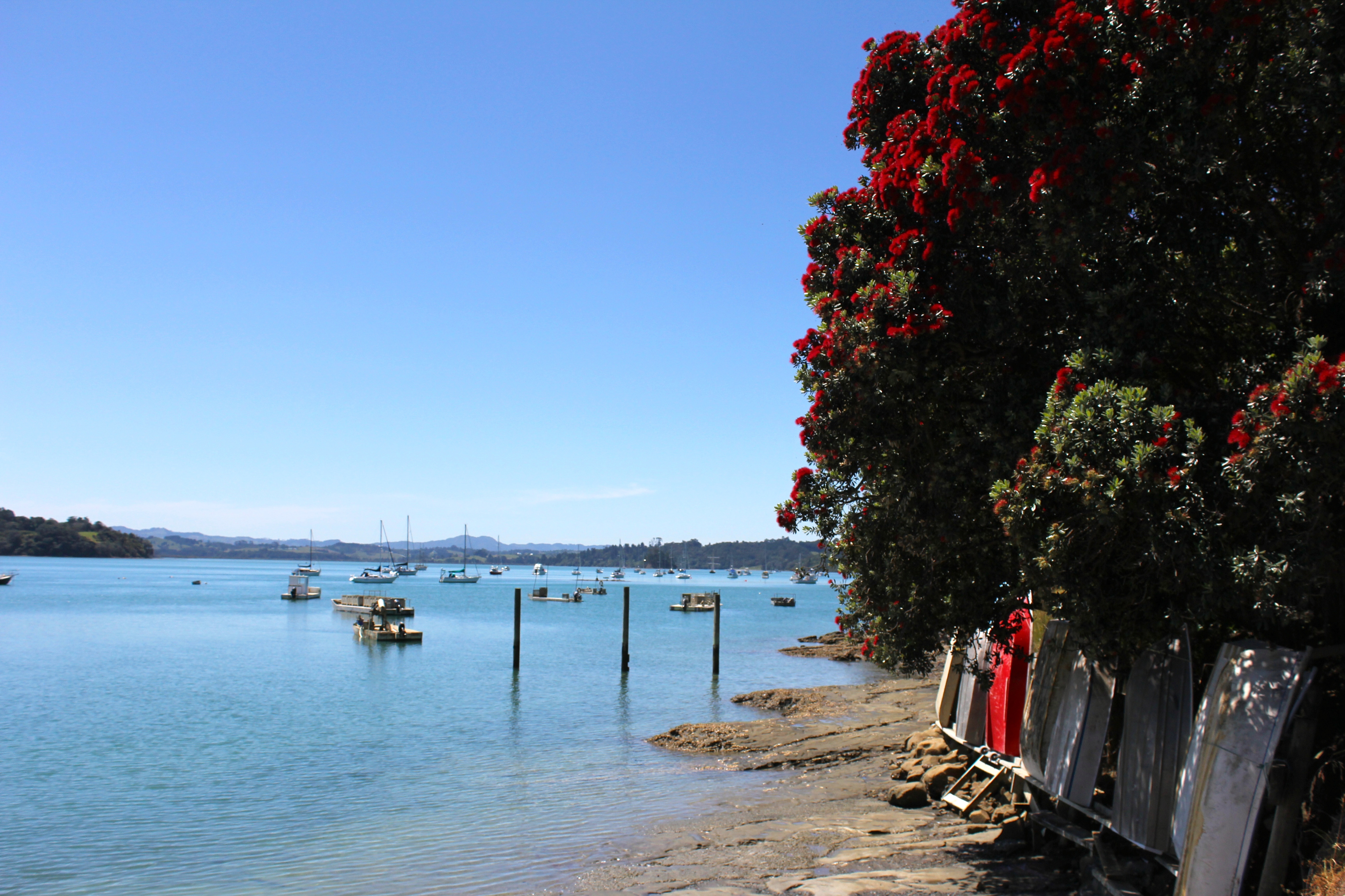
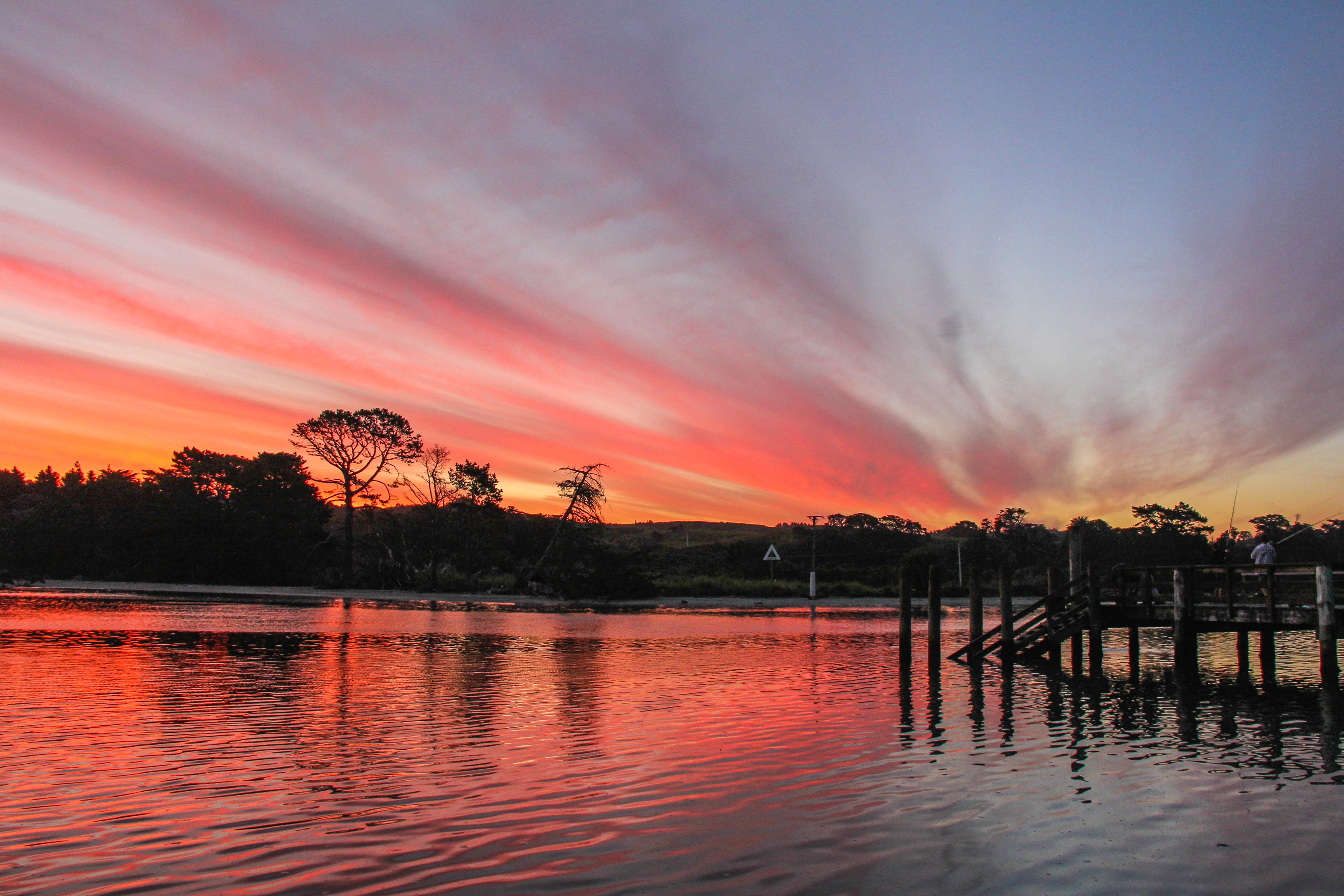
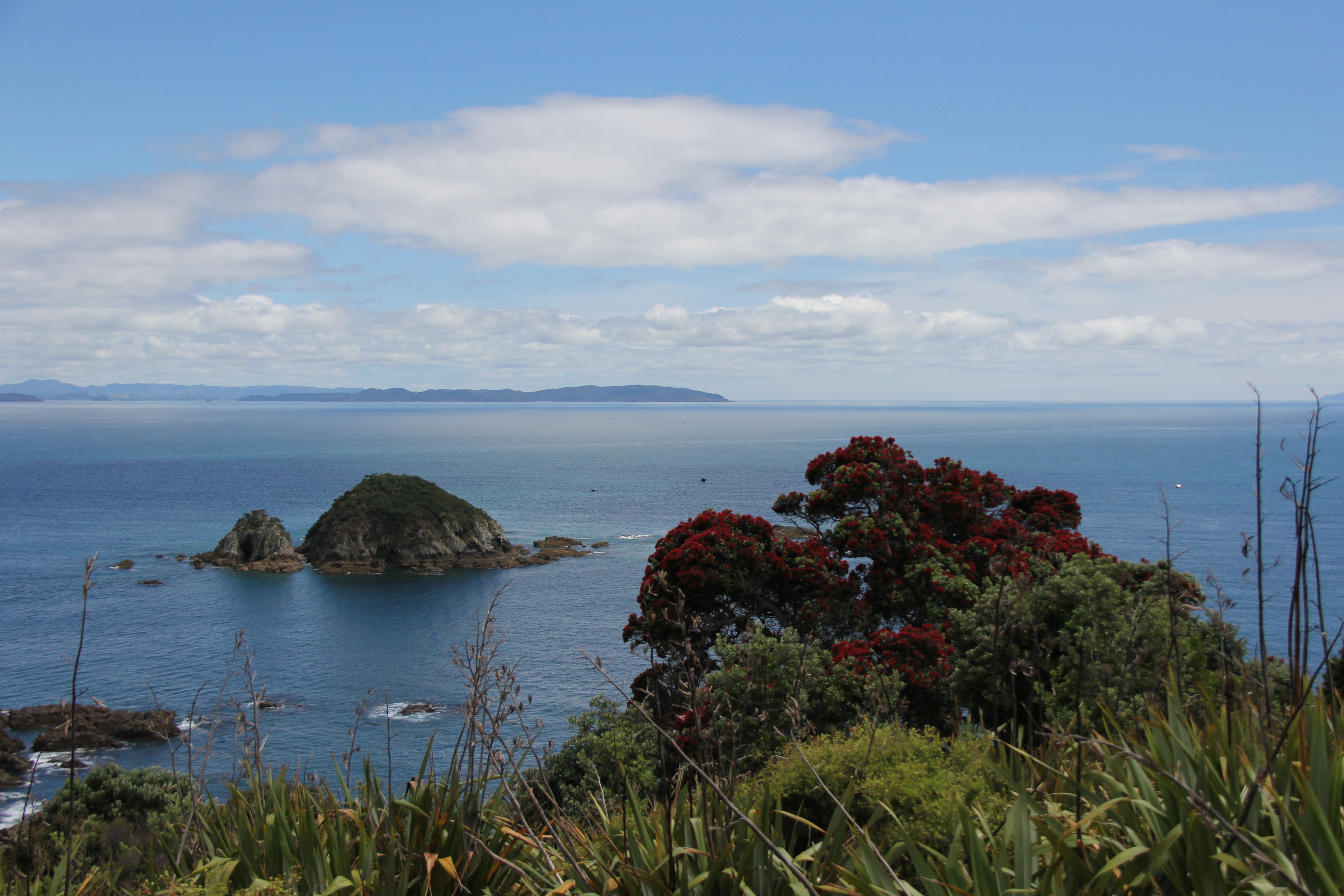
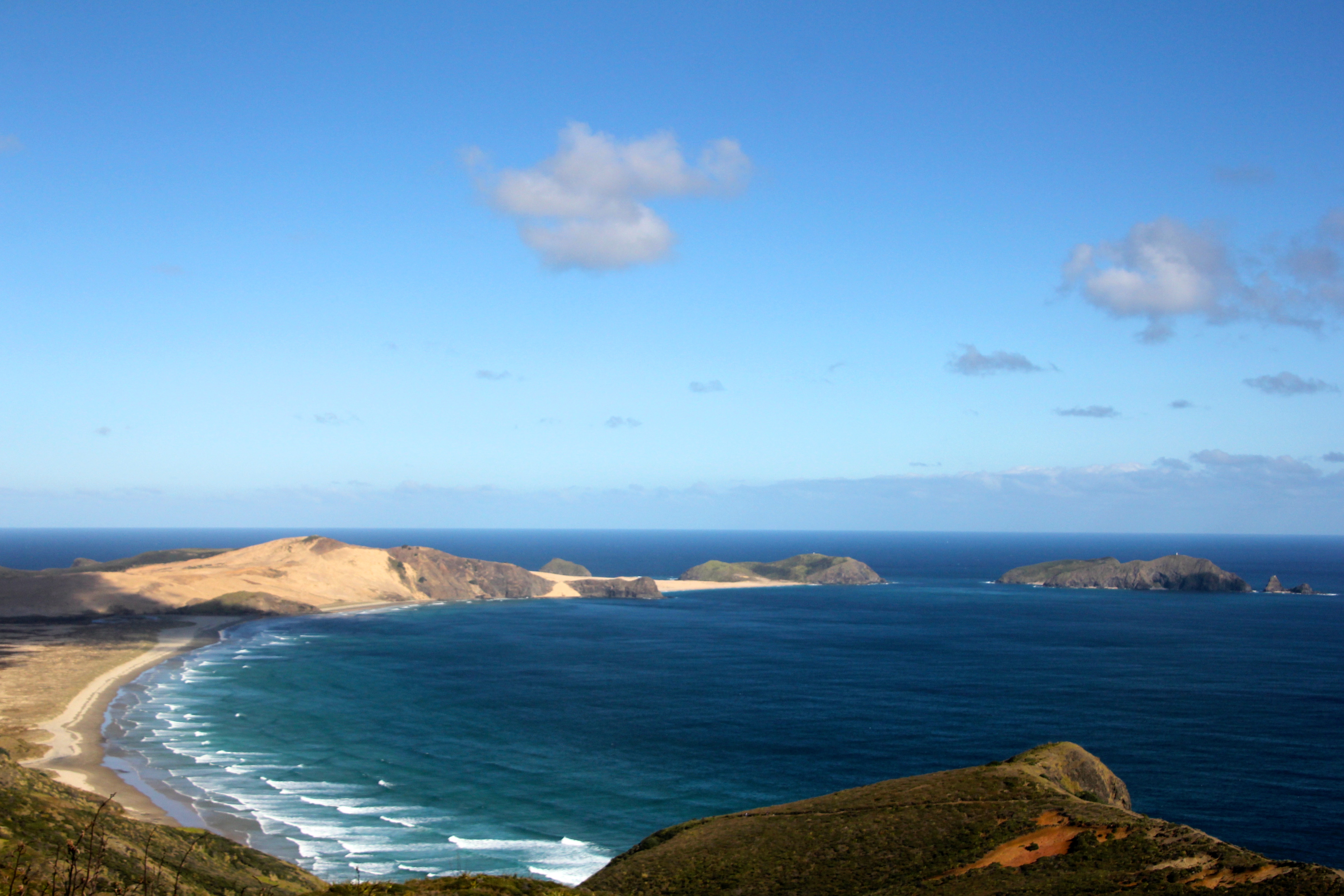
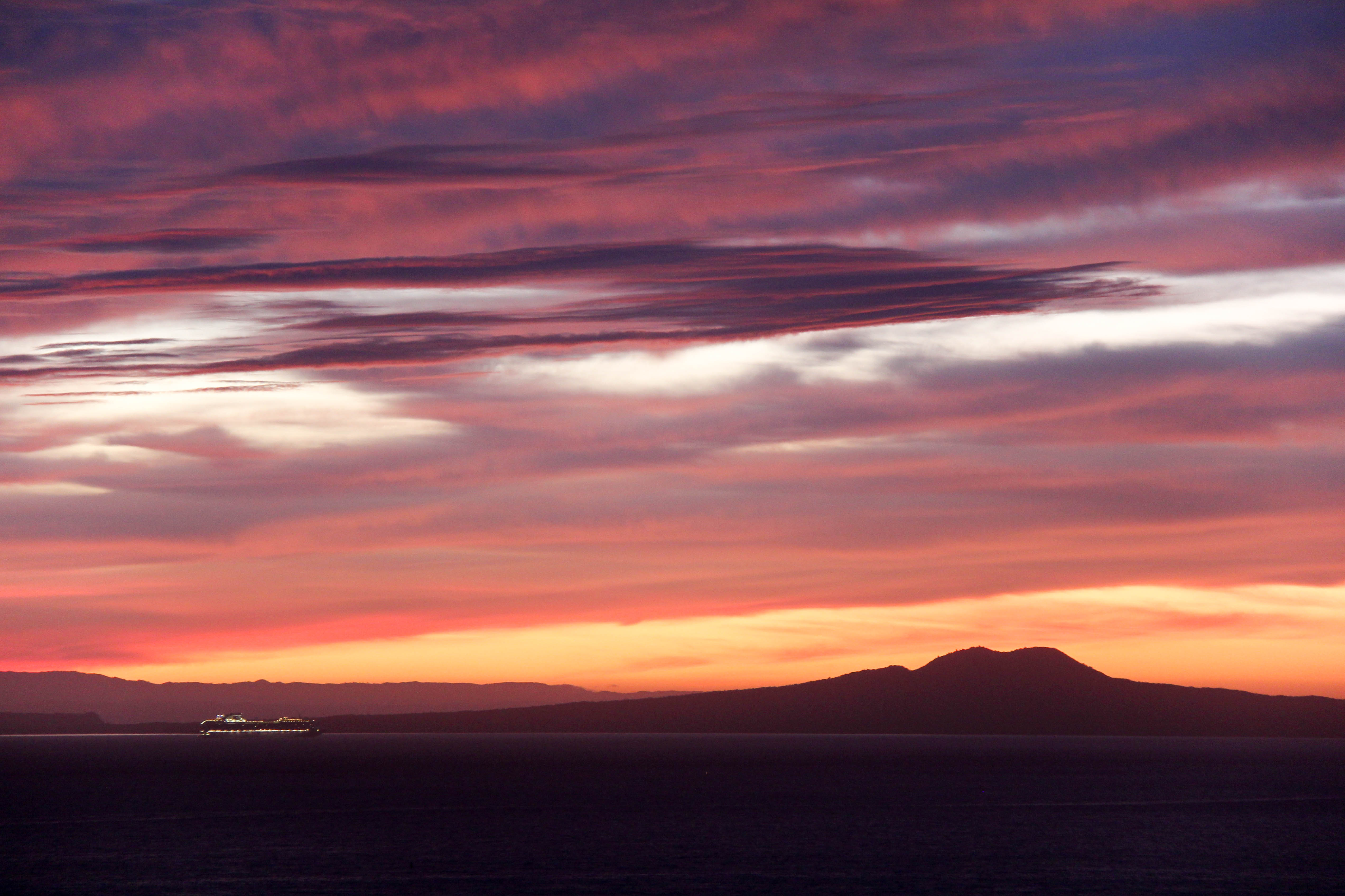
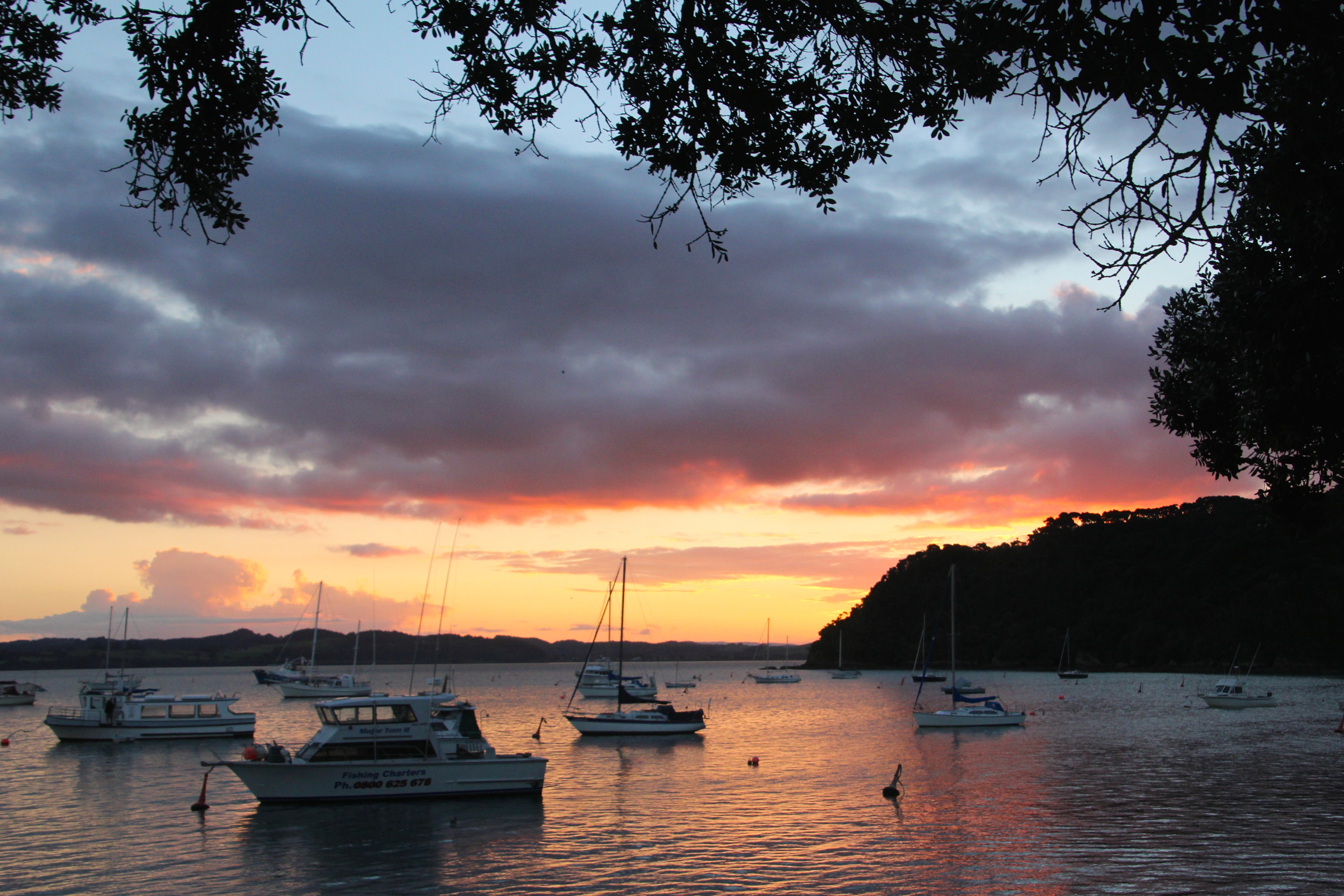
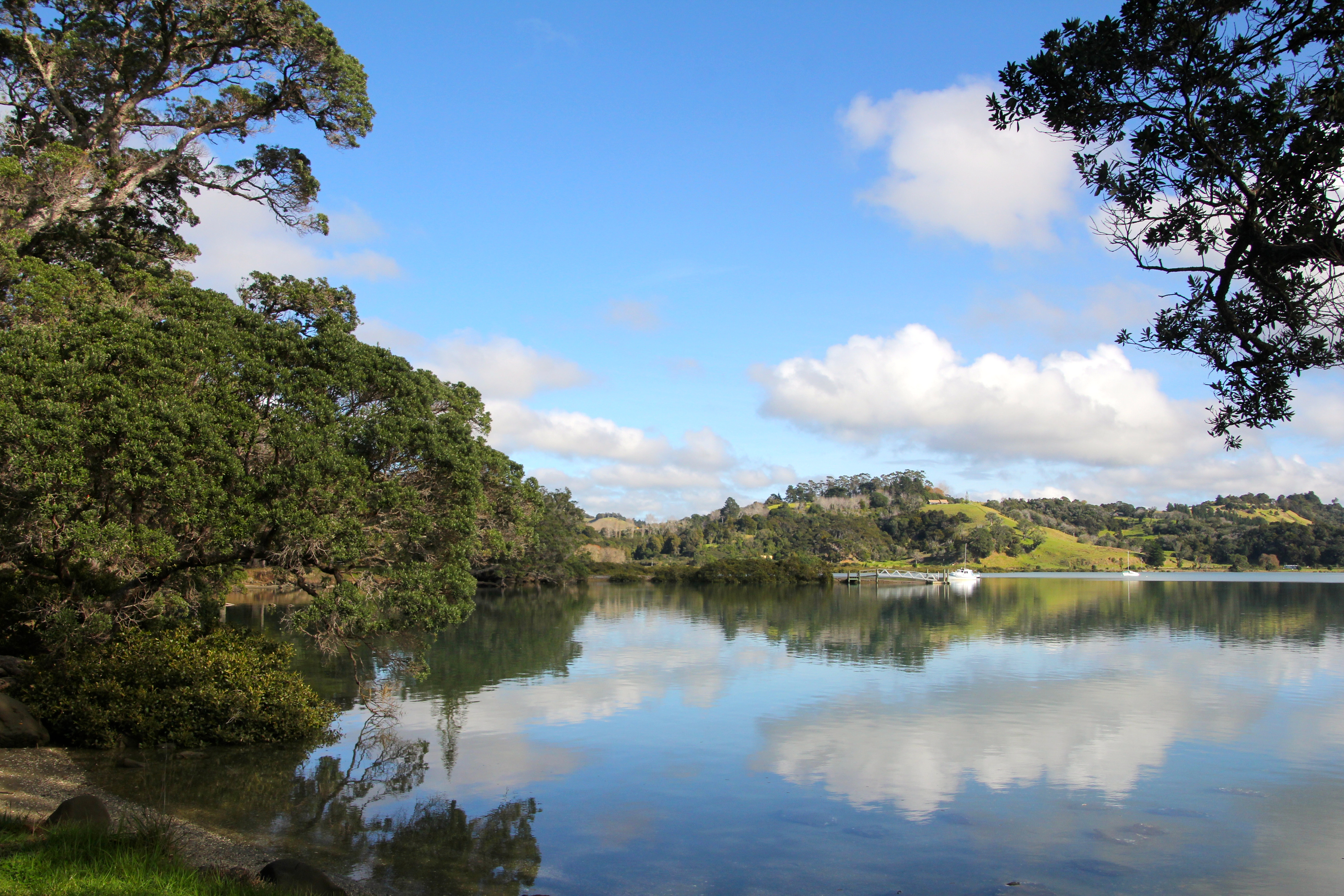
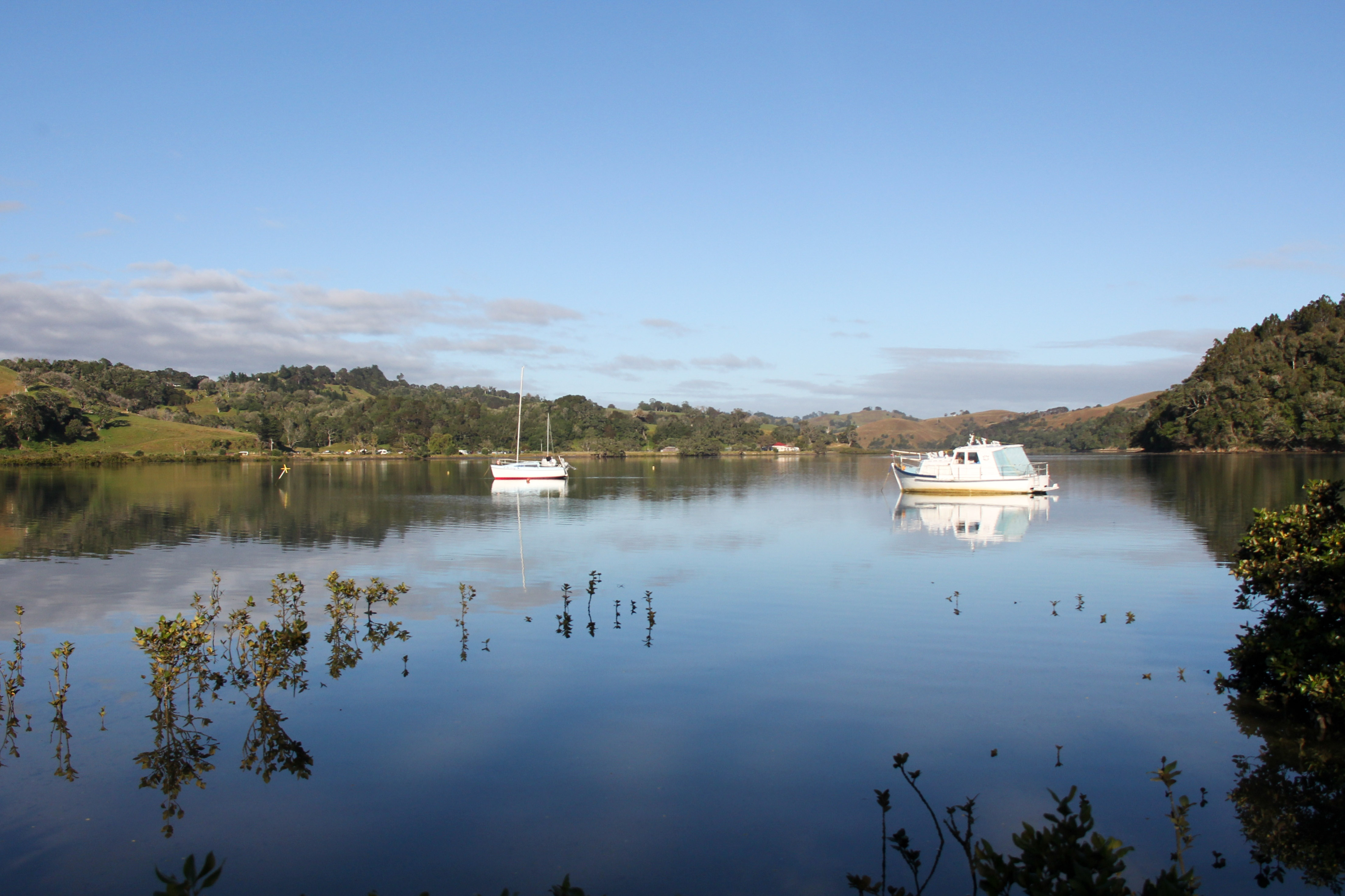
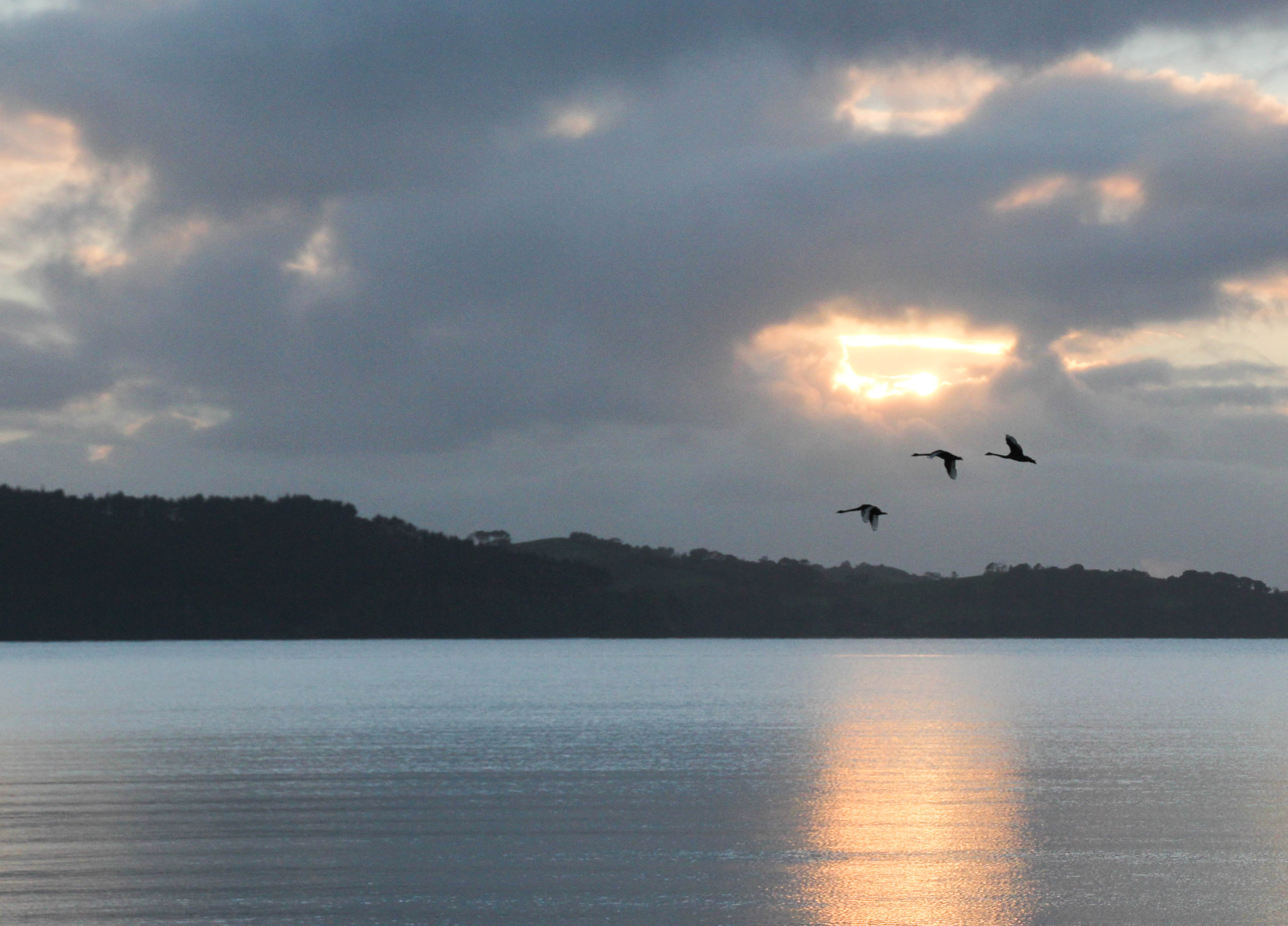
Christmas is coming! Pohutukawa in bloom. People in the Northern Hemisphere will tell you a snowy scene is better. While they shiver in front of their fires in the dark, mid afternoon.I left the house to take this. I mean I know all my pictures require me to at least leave the room if not the house. But I popped down to the river to catch the last rays of this sunset. Pretty cool as it turned out. I even managed to catch some kids fishing off the jetty.I went for a walk along the beach at last light, saw a bloke fishing. I don’t think he caught anything though. He seemed happy enough.Our coast is the most beautiful coast in all the world. I’m not at all biased. I consider beautiful coasts on their merits.This place is called Fishermans Bay. Seems like people with boats have taken this as a literal description. Or maybe they like it because it’s a nice place to park a boat?This is Cape Maria Van Diemen. She was the wife of Abel Tasman’s boss. He must have liked her. The North Western most Point of New ZealandA cruise ship entering the Hauraki Gulf. Which is where you arrive in Auckland from the open sea. Taken at 5:30am. The ship is the Diamond Princess. That’s Rangitoto Island behind her. It’s quite a scene really. All things considered.Gnarly old Pohutukawa stump, with added sceneryThis is from Mahurangi West where most people never go, they don’t go to Mahurangi East much either. New Zealand has an awful lot of places with few people visiting. Which is most excellent for those who prefer a bit of solitude with their awesome natural beauty.If you found yourself in Russell of an evening, and fancied a quiet refreshing beverage. You might have this as your backdrop, or foreground, depending on where you sit.Most people don’t stop here. They are too busy sitting driving north or south on State Highway One, about 5 kilometres away. Silly really as this is clearly a very peaceful place to stop. Wenderholm.This is also Wenderholm. It get’s two pictures here because it’s so terribly calm and peaceful. This was taken at 8am on a Sunday Morning. When you were in bedUnder the Jetty at Tolaga Bay. The longest Jetty in the Southern Hemisphere. This is the much sought after, under the jetty shot. All you have to do is get here, which is miles from anywhere, on a nice day at low tide. Simple
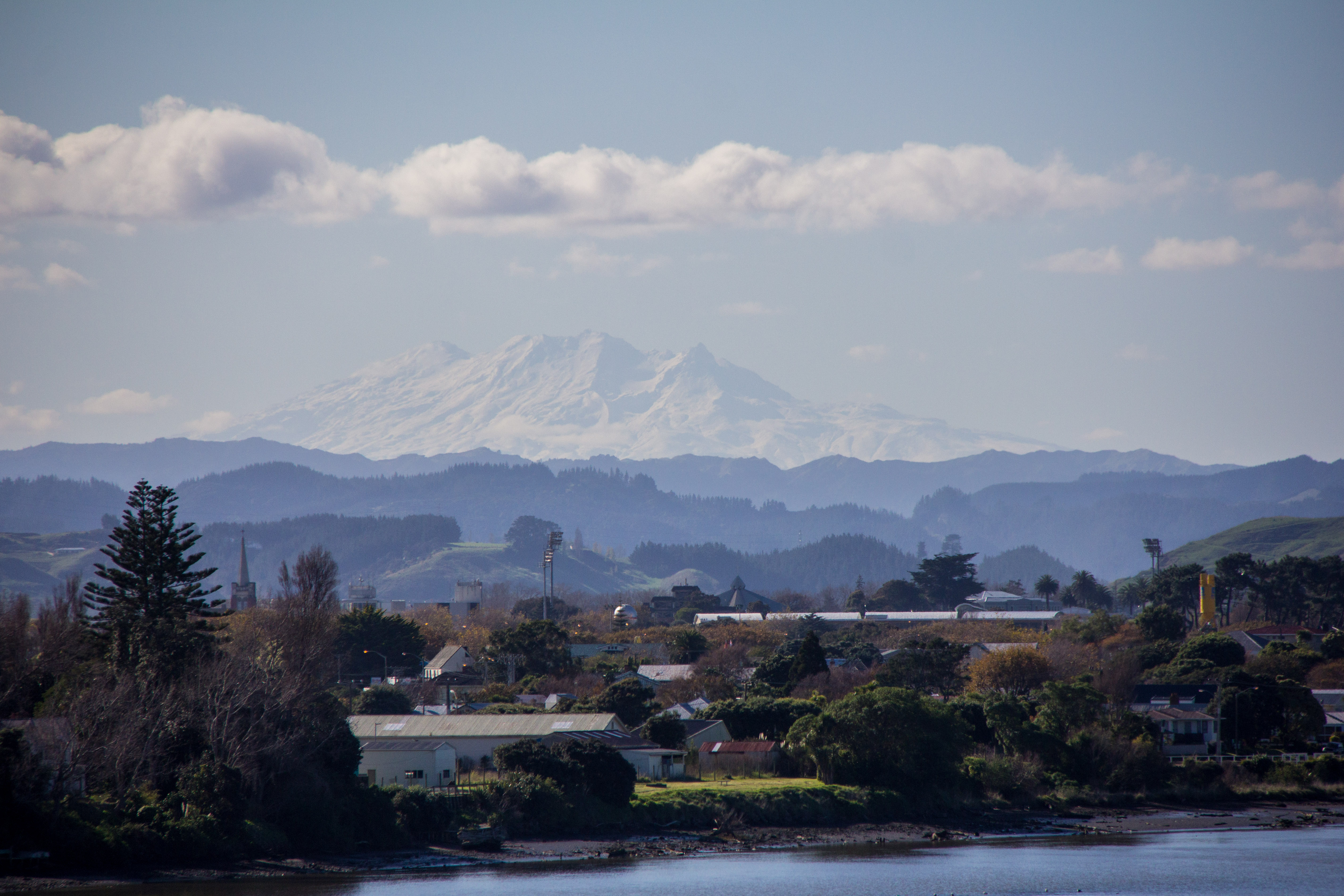
Ruapehu and Ngauruhoe from the road heading for Pipiriki, past Raetihi. On the way to the Wanganui River road. It’s all tar sealed now you know?Peering through the rail underpass at Mt Ruapehu. Not much of a risk of being run over by a train in New Zealand.Taken from SH4 at dusk, Late Autumn, late evening. It’s a pleasingly symmetrical mountain.Taken from National Park village at dusk. That’s Mt Ngauruhoe again. That was the actual colour of the sky.Just taking pictures of Mt Ngauruhoe, while Standing in the middle of SH1. You can do that in New Zealand. Take pictures in the middle of the road. Not because it’s allowed, but because you can.Clouds, not smoke above Mt Ruapehu. It’s a 10,000 ft, give or take, live Volcano.Because Mt Ruapehu is so very big, you can see it from very far away. Like this from over 100 miles, or 160 kilometres distant.
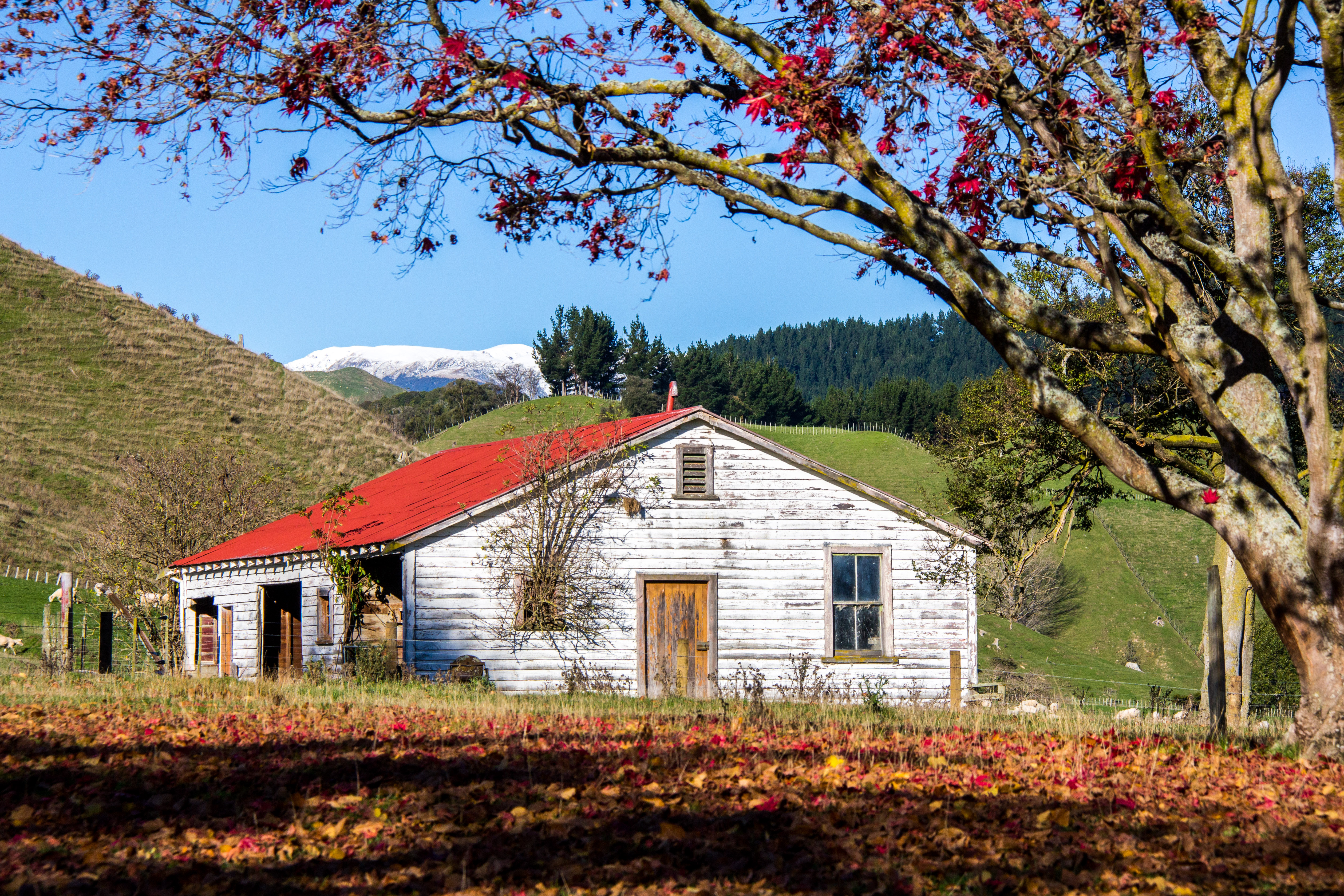
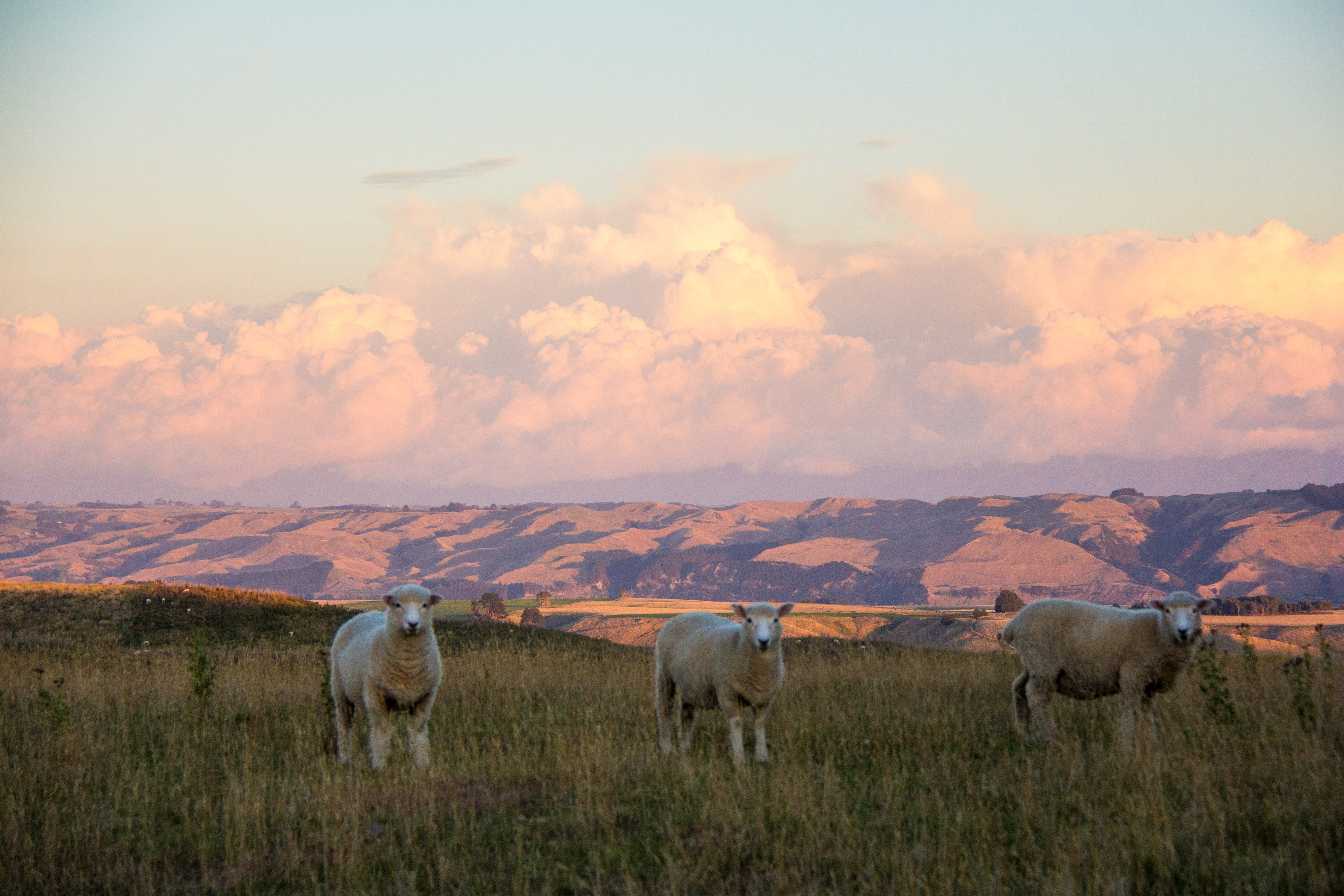
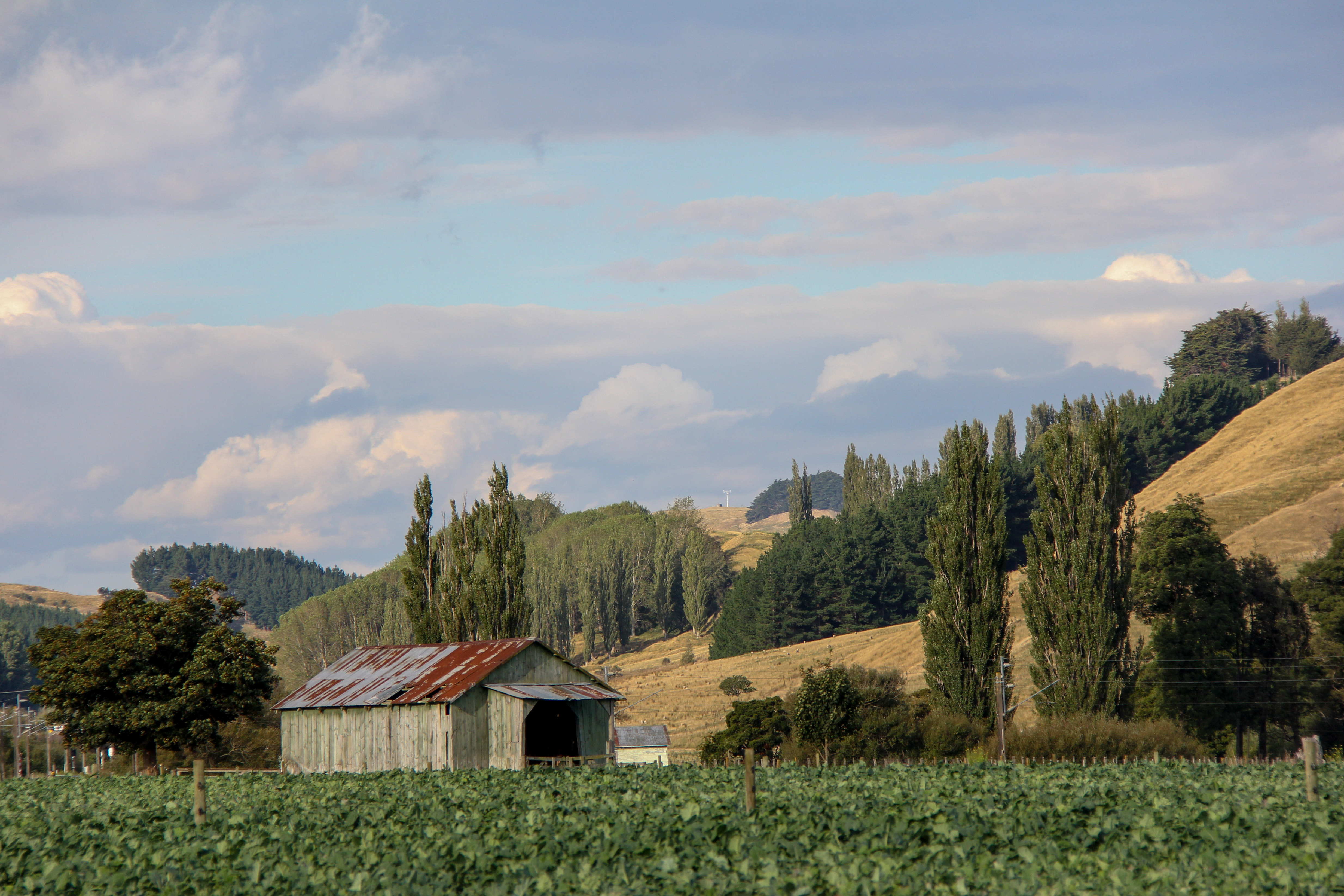
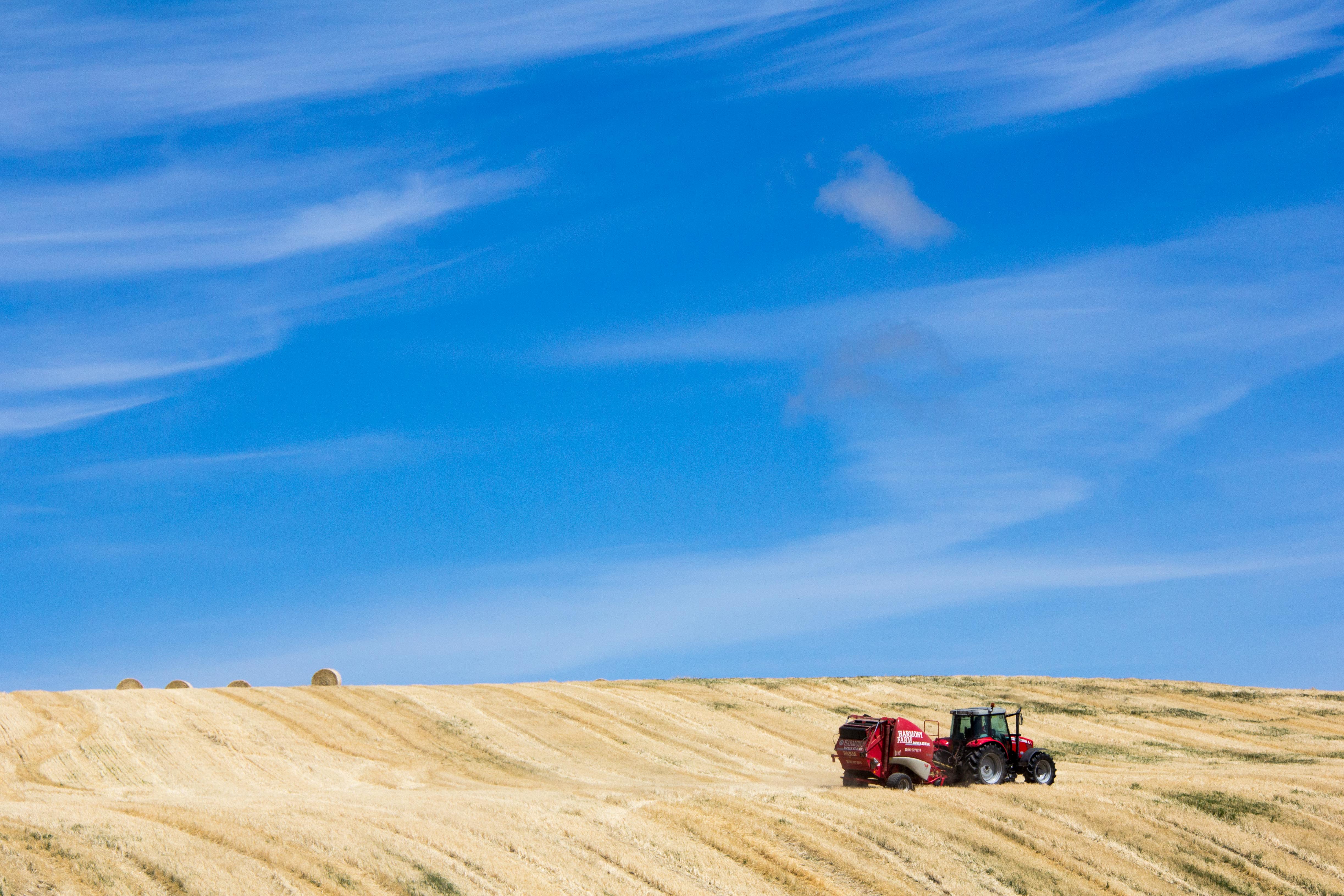
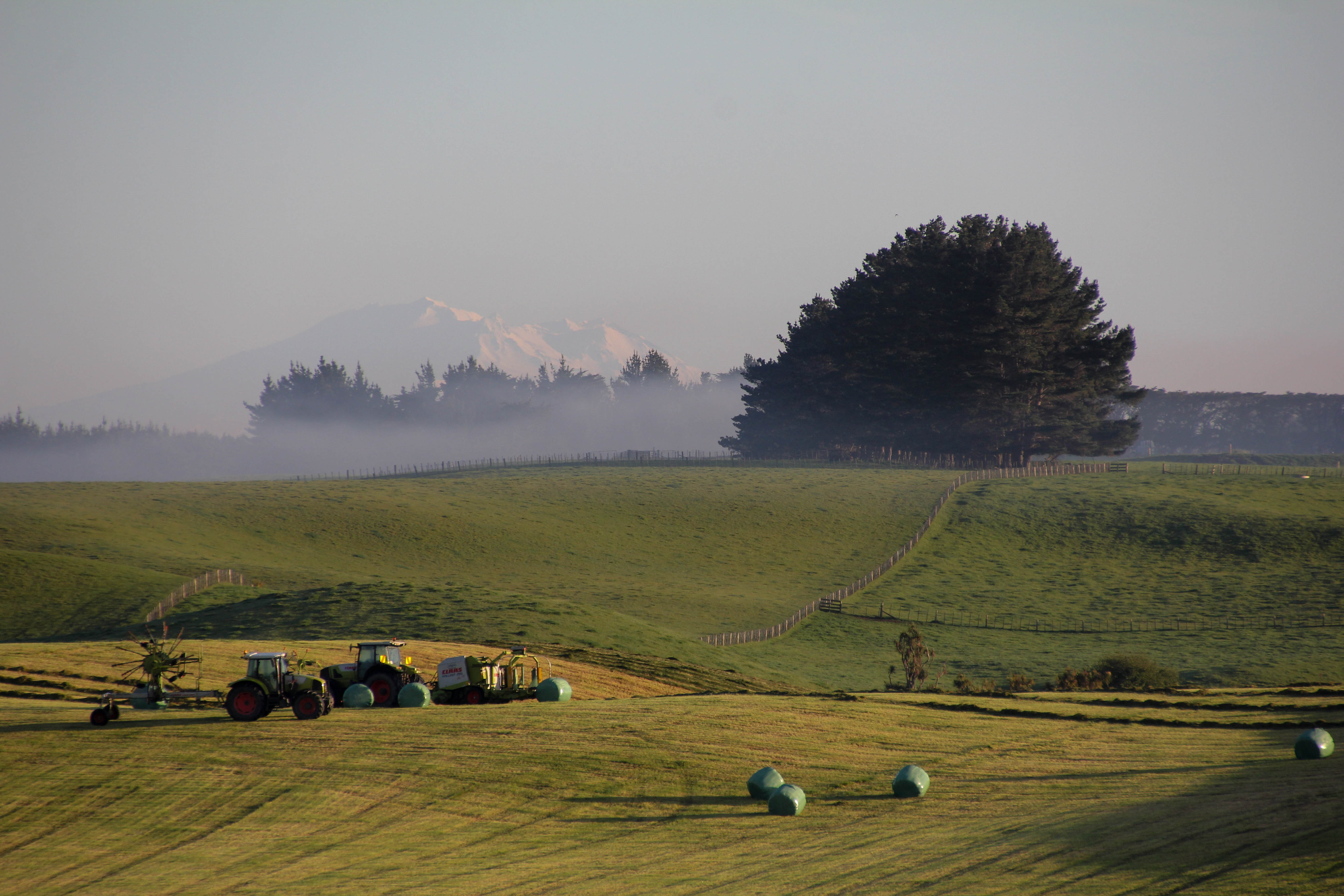
Central North Island, near Hunterville, this scene reminds me of a song by the New Christy Minstrels called ‘Green green’. I wonder why?Reflective Rangitikei. Near Hunterville, no Hobbits here. Just a cow having a lie down.Hay baling. I hated doing hay. Worst job of the summer. Mind you, the hay paddock can be a scene of some pretty epic summer colours if someone else is doing the work. Which is the best way to get the hay in.Autumnal Barn beside SH54, Vinegar Hill. Yes we do have autumn in New ZealandNot Mt Doom, Mt Hikurangi, East Cape. Tokomaru Bay is to my right. Quite the contrast on the snowy mountain in the distance.Early morning in the hay paddock with Mt Ruapehu, over 150km’s distant. They don’t get up early round here. Note the absence of work taking place.The Rangitikei River. One of our finest, most beautiful winding rivers. Part of it was used as the Anduin River in the Lord of the Rings films. This information seems to have bypassed most of the LOTR fans who head straight for Hobbiton (which is in the Waikato. I’m pleased to say I had to look that up) and the South Island. Not so many Hobbit geeks wandering around the Rangitikei.Old barn with the evening sun striking through. Between Kimbolton and Cheltenham. Sheep are unimpressed with an impressive sky, they prefer grass.The derelict cottage beside SH1 near Marton. Early morning light. With sheep.Fletcher flies low over a fenceline in the Rangitikei. Bet he did that on purpose, to show off.Sun set on the sheep yards taken looking west from Mt Curl in the Rangitikei. Mt Curl is more like a hill than a mountain.The Te Apiti Windmill Farm on the hills near the Manawatu Gorge. Many people hate windmills because they are an ugly blight on the landscape. If you’ve ever seen this windmill farm, you might change your mind. I think the word you might choose over ugly, is awesome. Even though awesome blight on the landscape still doesn’t sound like a good thing. They are an amazing sight and apparently also generate an awful lot of electricity. Which is a good thing. There are more than 3 windmills…See, more than 3, there are dozens. Most of them are behind me though.
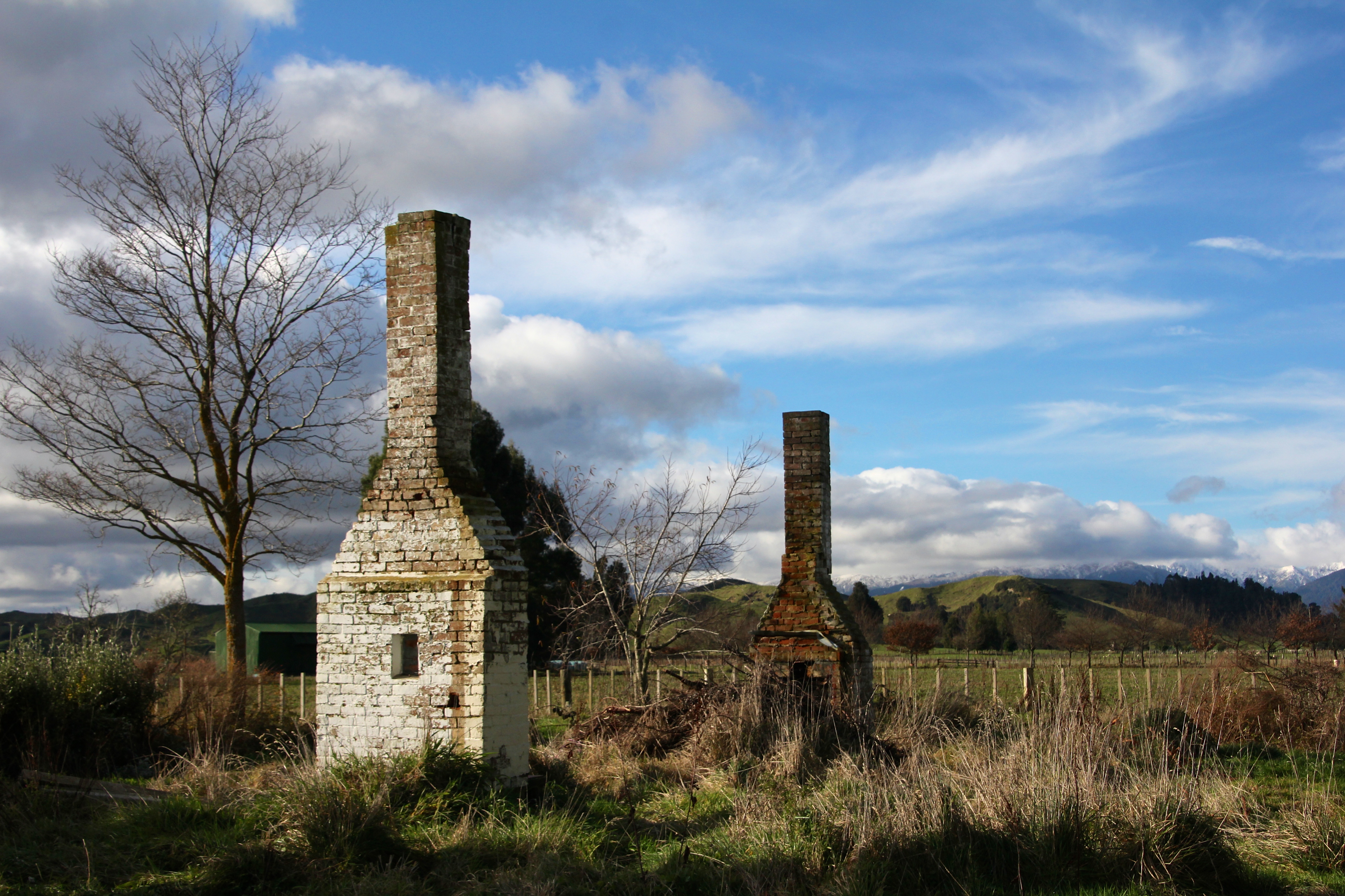
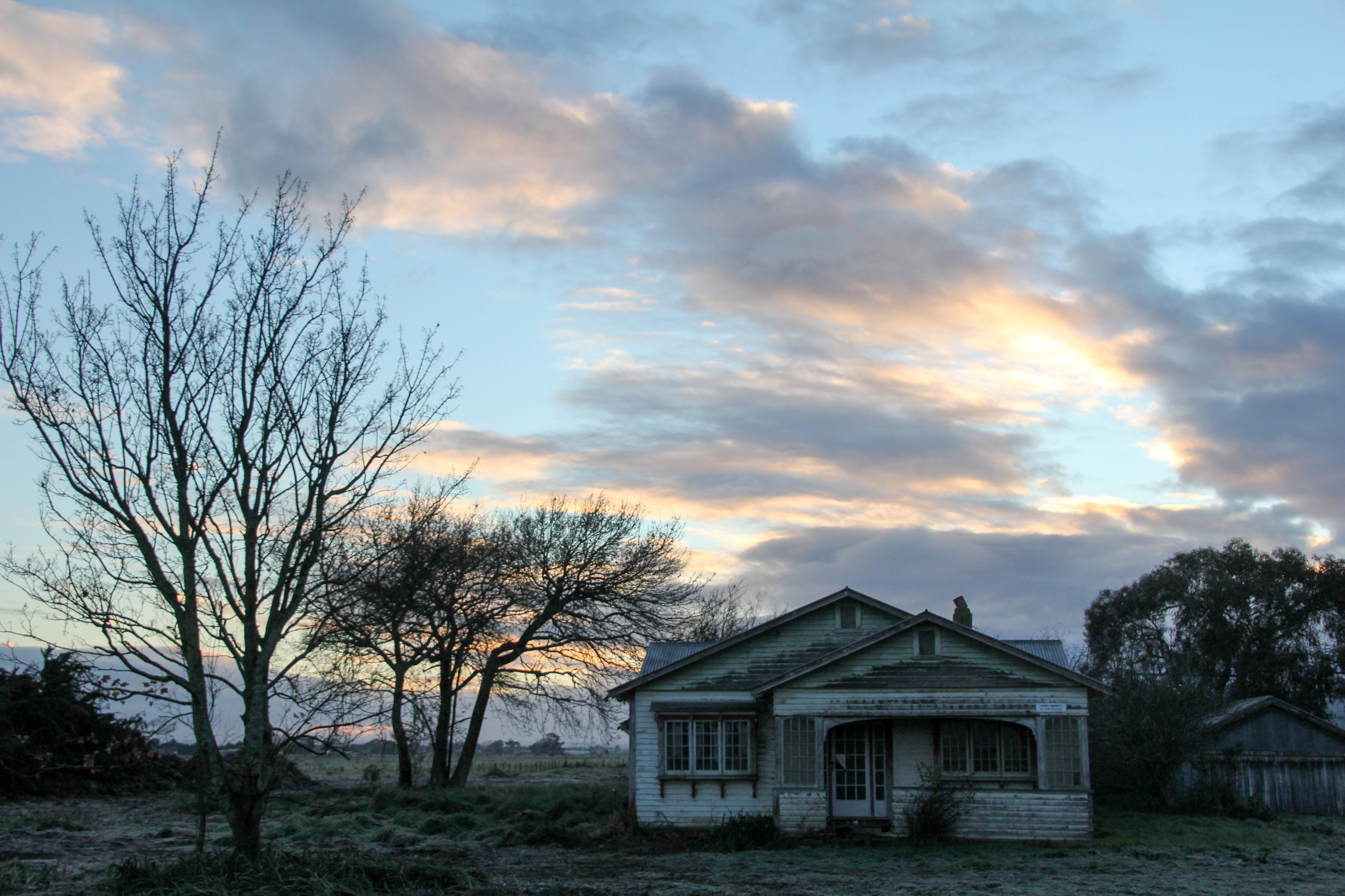
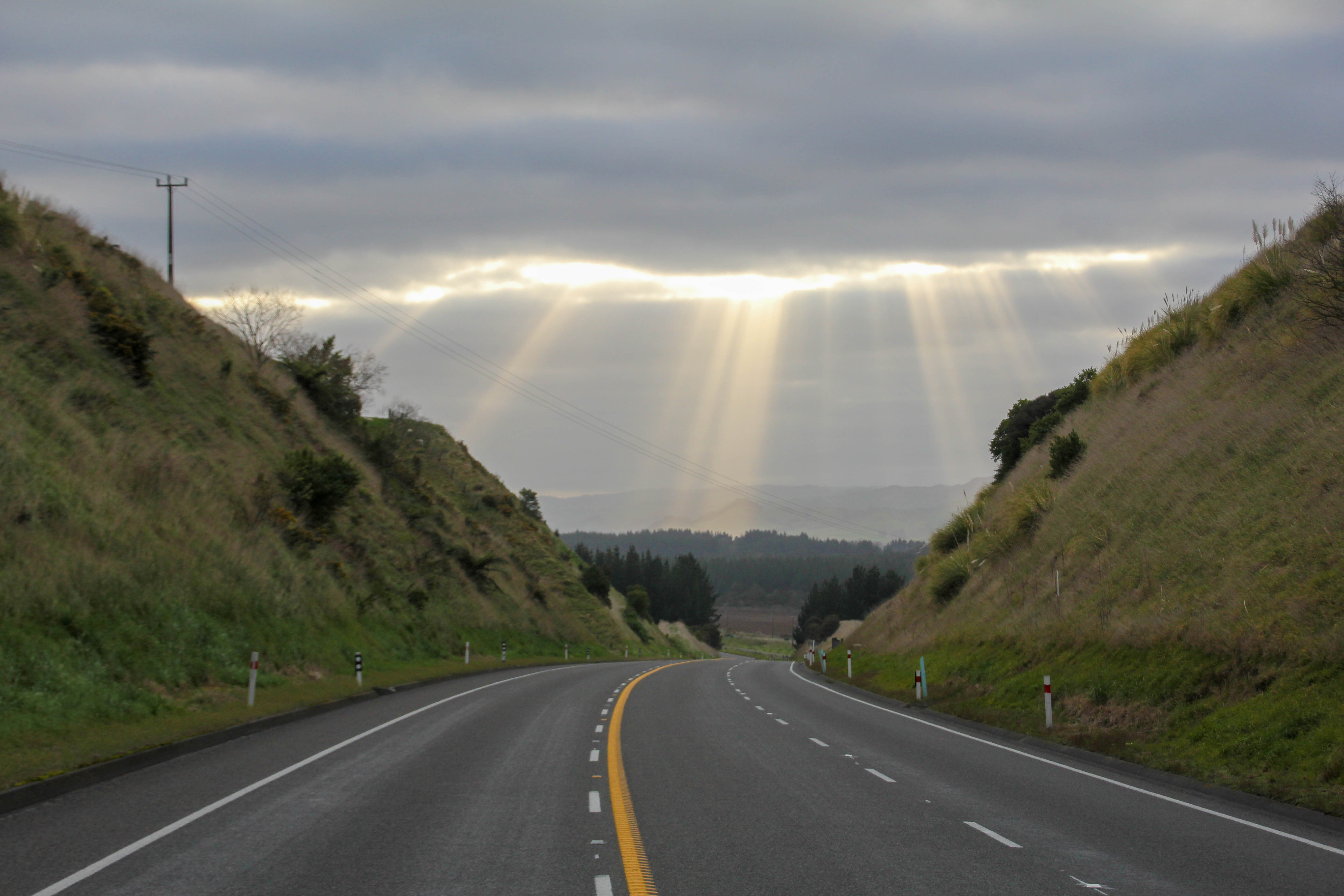
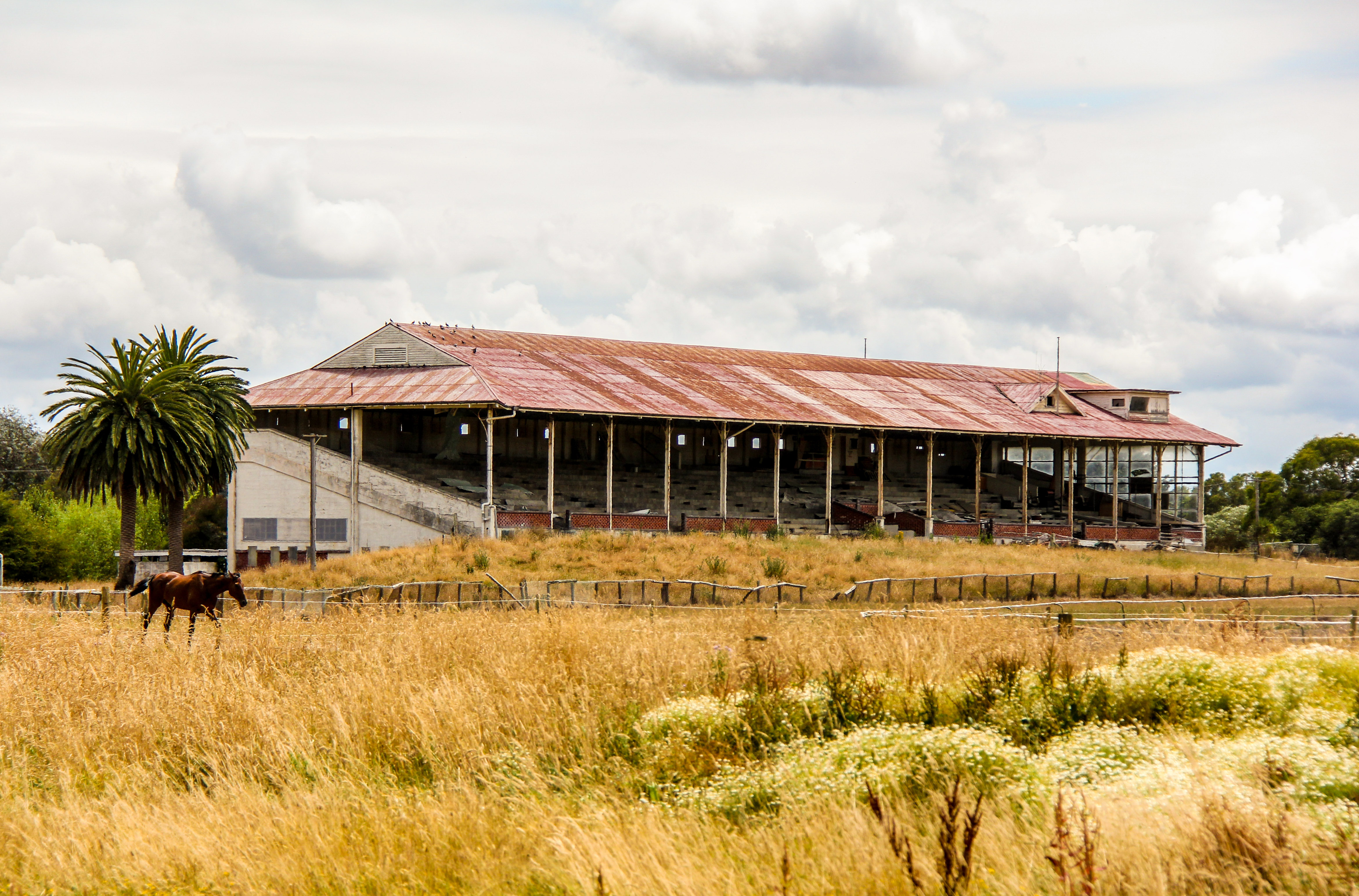
The remains of a long forgotten cottage in the Rangitikei. I call it…’no smoking’.Spooky old house in the Manawatu, gloomy morning. Rural Manawatu lends itself well to the miserable and moody.Geese crossing Kawau Bay at sun rise. I like when Geese fly into my shot.Chimney’s, no house. Rangitkei. No smoking.B&W of cool old barn, for those who prefer B&W. I’m not one of them.B&W of the old cottage beside SH1 near Marton. Sheep of the night.God rays over SH1 near Rata Straight first thing in the morning. I took this standing in the middle of our main road. Alone.Marton Racecourse grandstand. The crowds moved out in 1980. Maybe nearby Palmerston North was more exciting.