My happy place is in my car, on the road. I love driving around New Zealand as often as possible. If things are a bit dull around the house, I’ll go for a drive. I don’t have to go far to see epic things as luck would have it because I live in New Zealand. Epic is just around the corner. Last week I went for a slightly longer drive. Down to Christchurch, over Arthurs Pass to Franz Josef, down to Lake Matheson, up to Westport and back to Picton via the Buller Gorge and the Marlborough Sounds. This was my delayed Christmas holiday. I took a few photos along the way.
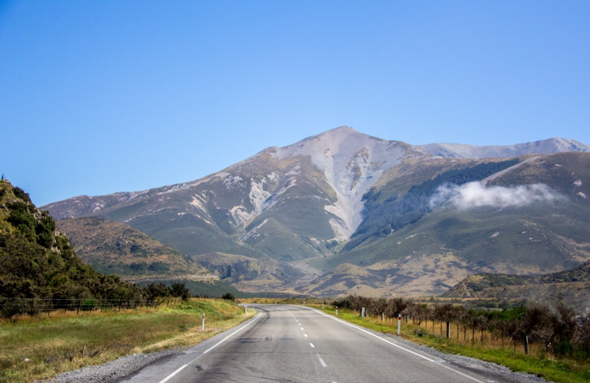
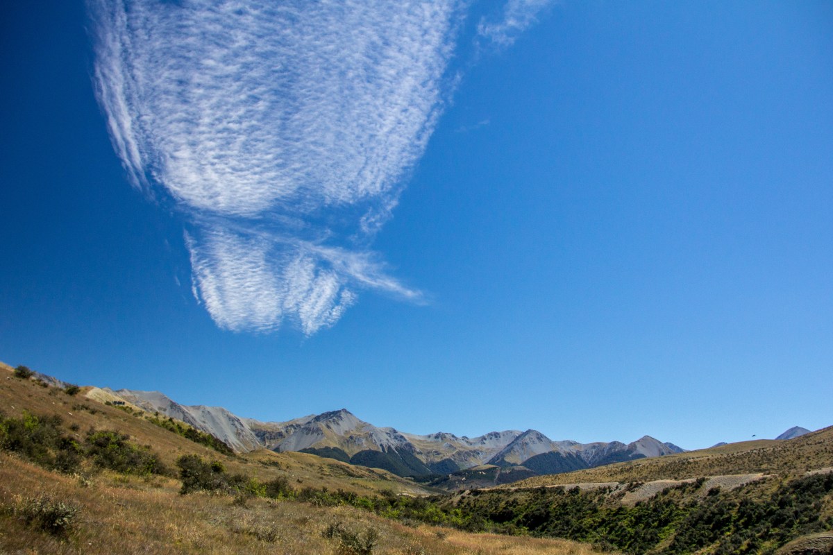
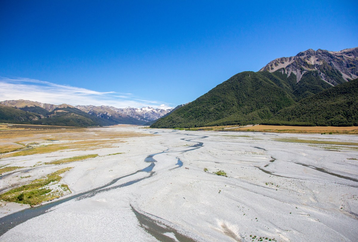
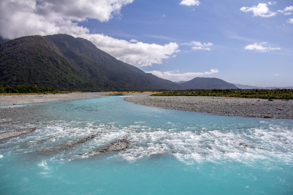
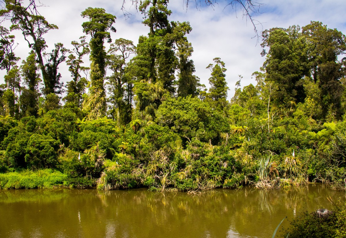
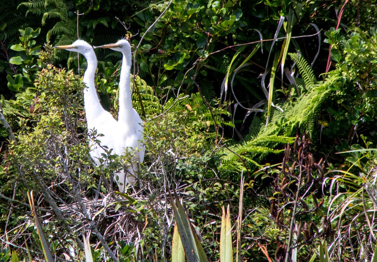
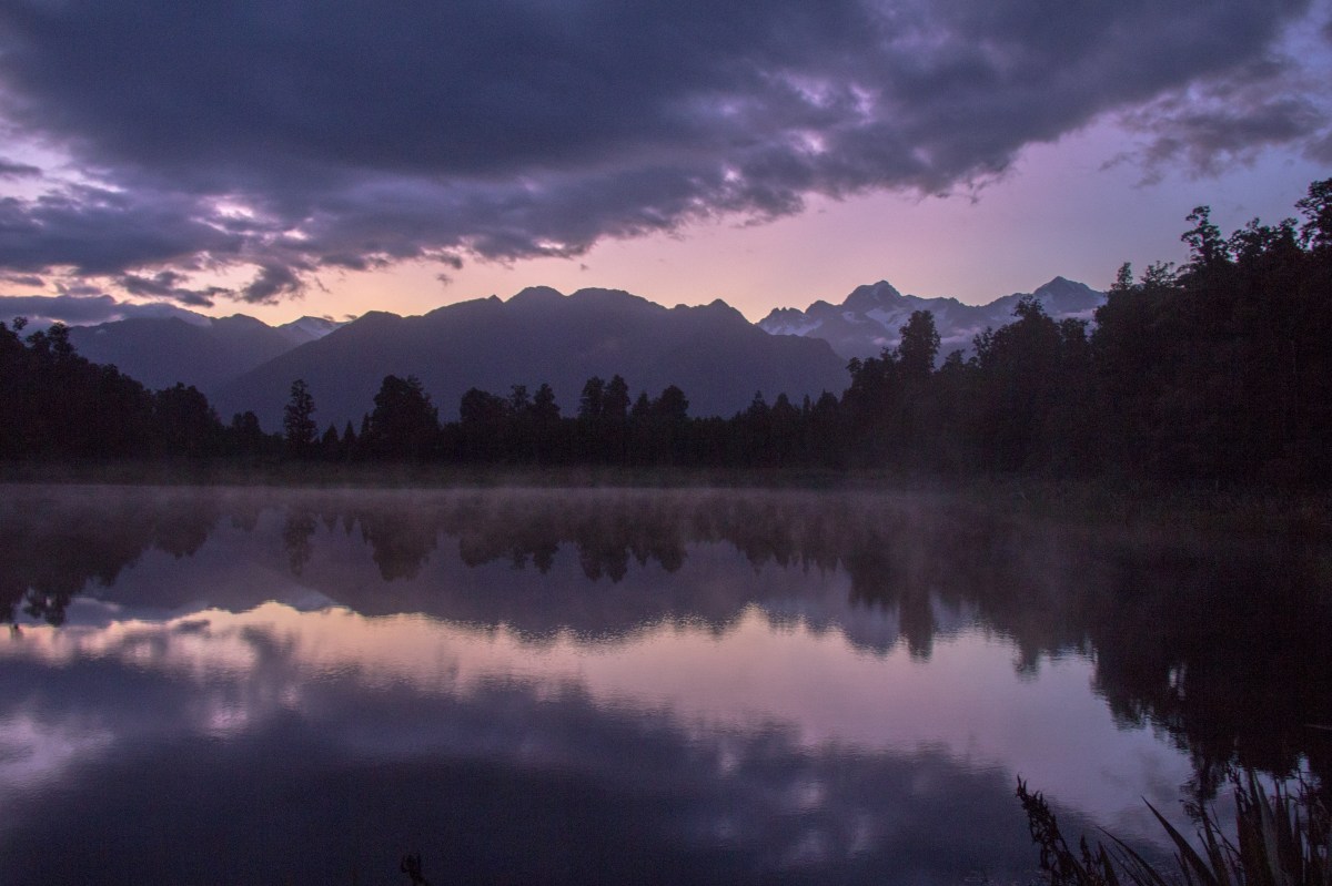
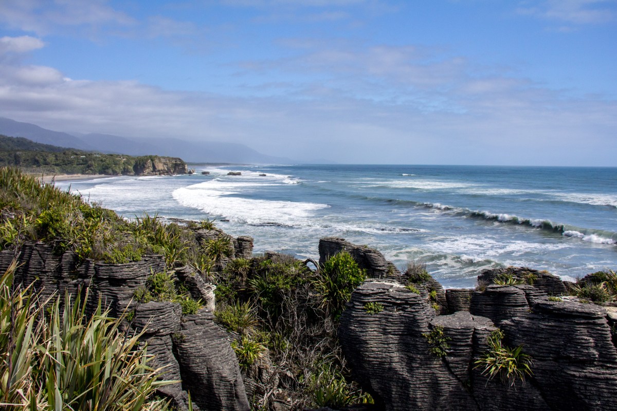
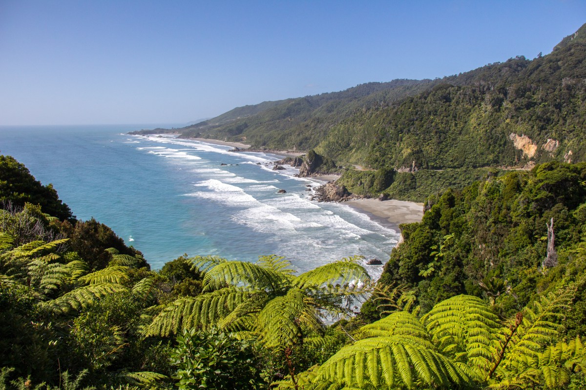
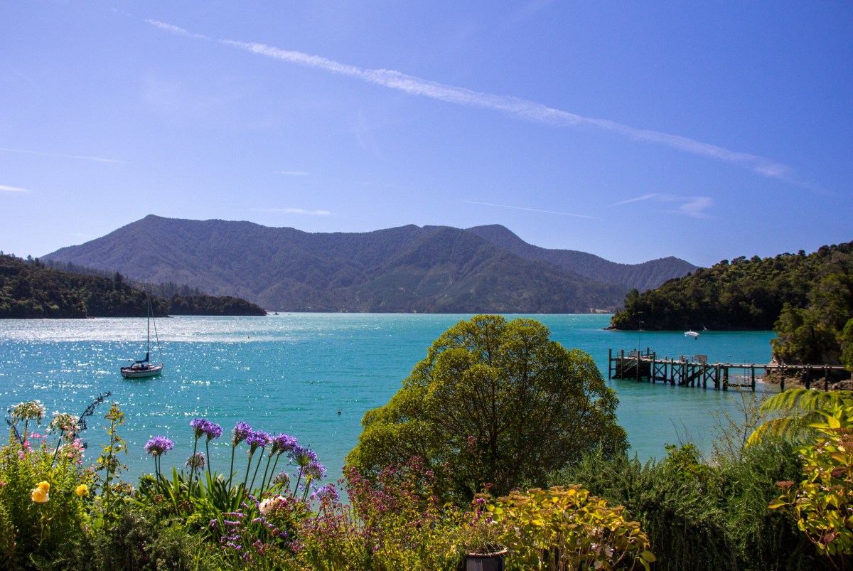
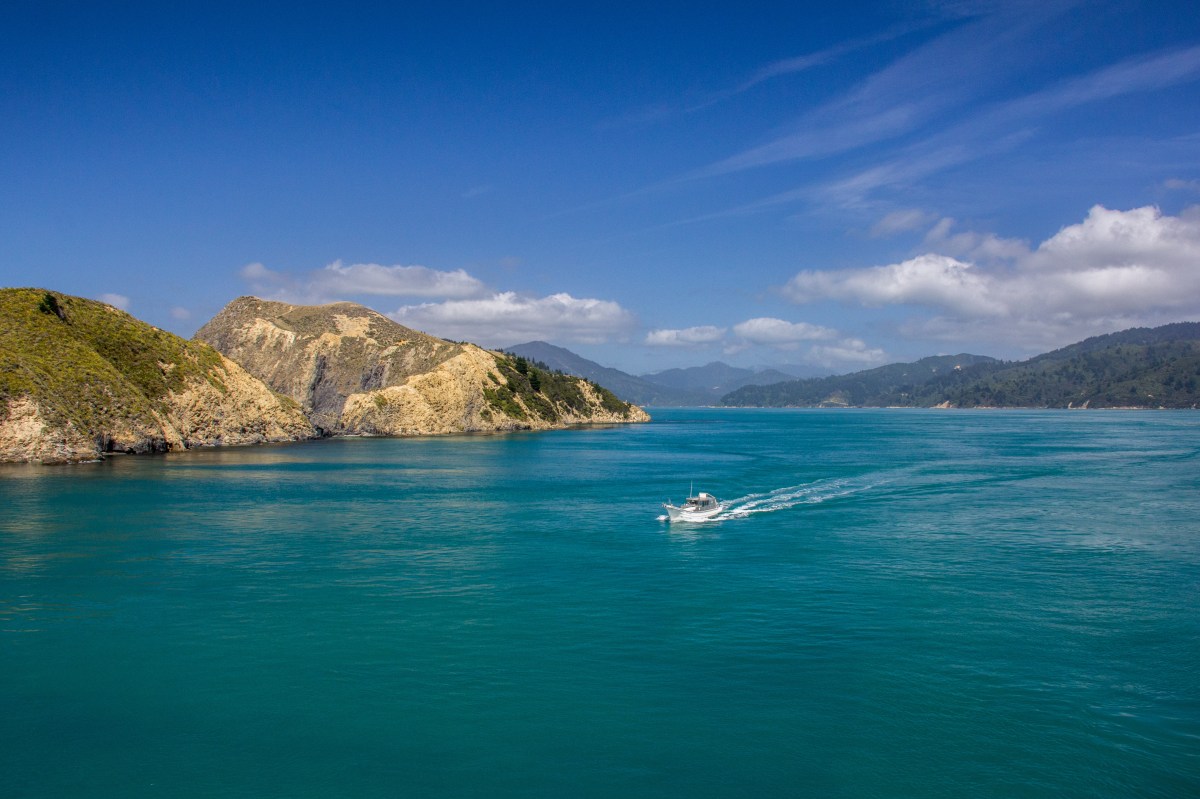
Sinclair Heads from Cook Strait. That’s the last bit of the North Island you see as you cross to the South Island.Looks like someone’s in trouble. Seals in Kaikoura.The Road into Arthurs Pass.Arthurs Pass Highway. It’s a bit barren up there. A lot of tourists though. There are only 3 roads that cross the South Island. This is the middle one.Awesome clouds above Arthurs PassThe amazing Waimakariri River Valley at Arthurs Pass. Mid summer. Bit of rain must be due?Glacial Water in the Whataroa River. It’s very cold.That’s where the White Herons nest in New Zealand. Just there. Only that little bit of forest, nowhere else. It’s quite amazing really. When I say that bit of forest. Just that little bit there. That’s all of it, their entire nesting area.Young pair of White Herons.Lake Matheson in the pre dawn light. The clouds rolled in and covered up the mountains quite quickly. So you only get a shot in the dark on this particularly day.Lake Matheson with Mt Cook visible in the gap in the clouds. Mt Cook is Aoraki, the cloud piercer. True story, see?Morning dawning near Fox GlacierIn that gap in the mountains is Fox Glacier. There’s probably less of it than there used to bePunakaiki Rocks. Like stacks of pancakesThat’s the ‘West Coast’. Near Punakaiki Rocks. The entire West Coast of New Zealand is the West Coast, but this bit is called the West Coast.Looking north up the West Coast. It’s rugged and remote. I like it here.Buller Gorge. You can probably fish in that.The Buller Gorge. Better than the Manawatu Gorge if anyones asking.Buller River.This is Te Mahia Bay in the Marlborough Sounds. It’s nice here.Crossing through the Tory Channel from Queen Charlotte Sound into Cook Strait.
So that’s just the top half of the South Island. I didn’t take any photos of the Kaikoura Coast on the way down apart from the seals as I have a load from the last time I was there and the sky was pretty gloomy on this trip. Bonus seals though.
Happy travels…Just watch out for tourists paying more attention to the scenery than the road.
Well not all the bays, the bays out past the Airport. Wellington is the Capital City of New Zealand. It’s perched in a little bay with all the houses nestled into a load of hills behind it. Most people think it’s quite a pretty little city. I was visiting a friend but was early, so decided to take the scenic route round the Miramar Peninsula rather than simply drive across town. I’m pleased I did because look!
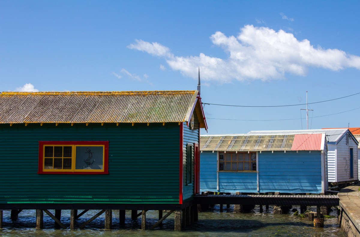
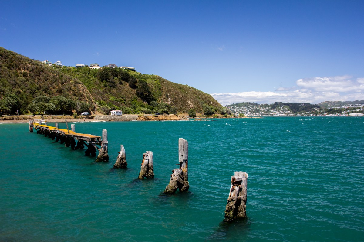
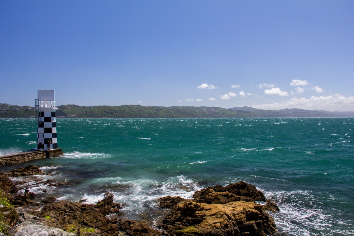
Ok, it’s not a bay, but this is one of those ‘classic’ shot’s of Wellington and is as good a place as any to start. Plus there is a bay, down there.The Wellington Waterfront from Oriental Parade. The beehive looking building on the far right is called ‘The Beehive’. It’s where we store our politicians.From Oriental Parade, no idea why it’s called that. People from Wellington like to walk along here, or run wearing lycra, earphones and carrying a water bottle.Evans Bay boat sheds. Cool.Broken pier at Shelly Bay.Another broken pier at Shelly Bay. Looking across towards Mt Victoria. It’s not really a mountain. That bit of Wellington on the hill that isn’t a mountain is called Haitaitai.The Point Halswell Lighthouse on the tip of the Miramar Peninsula.With a guy fishing off it.A busy sunday morning in Wellington. Heading into Kau Bay along Massey Road.Karaka Bay jetty, complete with old working phone booth.That’s still the Karaka Bay jetty, or pier. I like a nice jetty, or pier.Those are the pinnacle rocks looking across towards the Wairarapa from Breaker Bay. It was out there that inter island ferry, The Wahine, sunk in 1968. 53 People died.Flax Bay, over there is the very bottom of the North Island.Upside down boats lend a pleasing aspect to a coastal scene. Flax BayIn the distance is the South Island, the Kaikoura Ranges about 250 kilometres away by ferry and road. Taken at Moa Point. That ship is a Cook Strait ferry, the InterislanderAir New Zealand arriving int0 Wellington, flying low over Moa Point. It can get a bit hair raising flying into wellington on a windy day. It’s often windy, mostly.Looking across Island Bay. Time to turn inland.
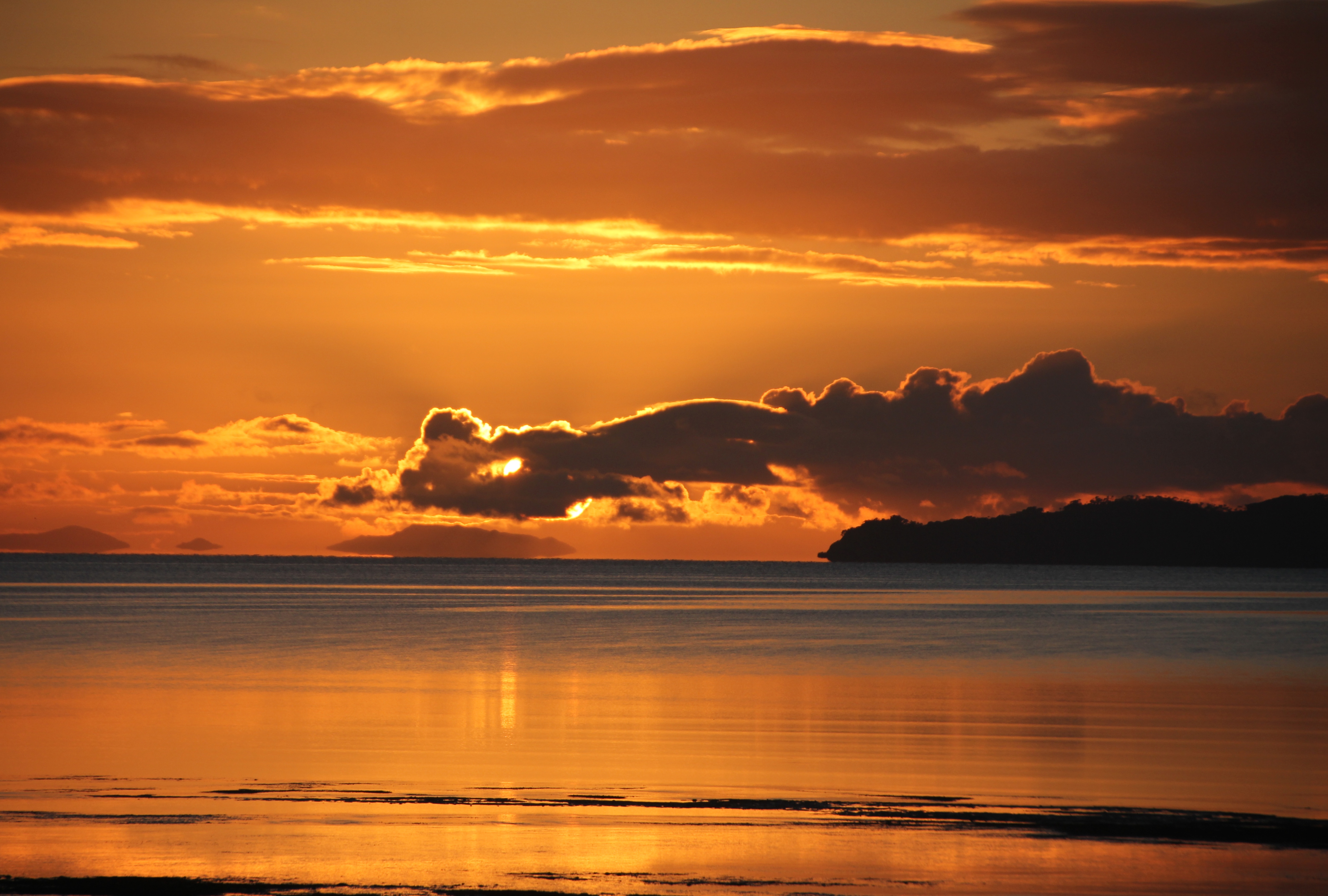
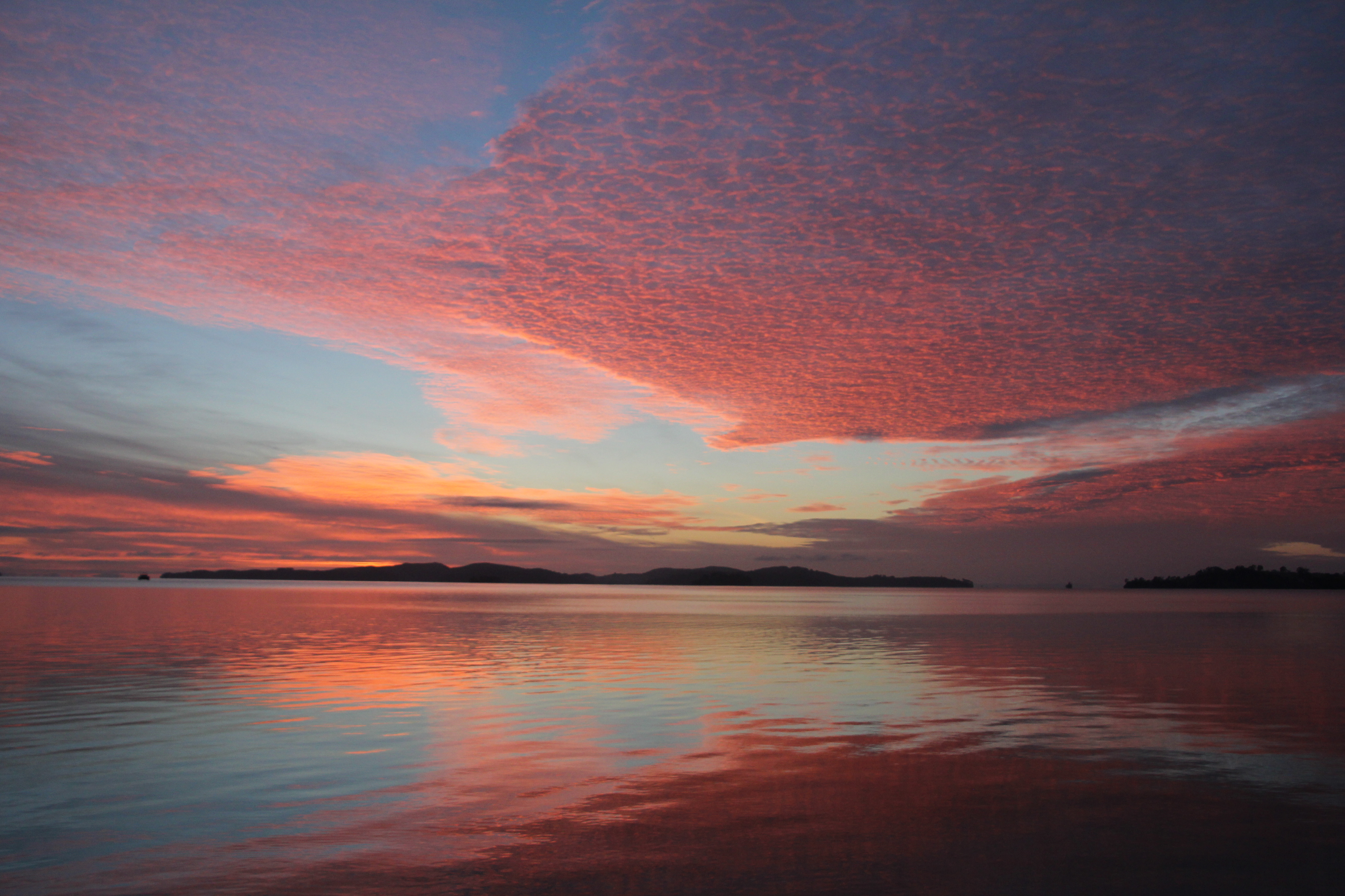
The dawn of 2014, 6:15am January 1st. The year appears calm in it’s arrival.June 7th, 2013. An unremarkable day arrives in a most splendid mannerJune 6th 2013. The day before the day before, up there, above this one. I never get sick of this stuff.The day dawned so awesome, even the seagull stopped to watch. You try getting an inquisitive early morning gull to turn it’s back on you.Peaceful morning in Kawau Bay. Still, the stilts have had enough.The day was going to be rough, possibly. Seagull flies into the shot. I have this exact same image without the seagull. Some prefer it that way.Just orange. Most people lie in bed and miss out on this sort of thing.Duck shooting season started at this very moment in 2013. The duck was probably better off where he was in Kawau Bay.Red Sky in the morning. It was a very nice day though, so there goes that old wives tale, or sailors legend, or something.